
The primary software used to display and animate these images was the GRASS4.1 module SG3d, but many other GRASS programs were used to prepare and analyze data.
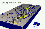
 --> Interacting Fields
 --> Surface Modeling
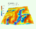
 --> Multidimensional Interpolation
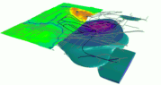 --> 3D Scattered Data Interpolation
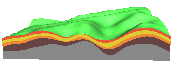
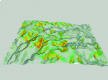 --> Terrain Analysis and Erosion Modeling
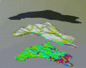
 --> Soil Geomorphology
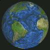 --> Global Images
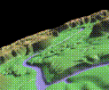
 --> Rainfall Runoff
 --> Keyframe Animation
This work was partially supported by DOD Strategic Environmental Research and Development Program ( SERDP ), Conservation Pillar, project: Digital Elevation Modeling and Erosion Simulation.
 GMSL Modeling & Visualization