
Using the GRASS module s.surf.tps, a surface is interpolated from data collected at scattered points. This task is common in environmental studies, as the spatial distribution of various phenomena (temperature, precipitation, concentrations of chemicals, soil properties) is modeled from discrete data collected at sampling sites or monitoring stations.
The interpolation method implemented in s.surf.tps is regularized spline with tension and smoothing . Tension and smoothing parameters allow the user to tune the character of interpolation to best represent the modeled phenomenon. These two animations show how changing tension and smoothing parameters influence the resulting character of a modeled surface.
 Changing Smoothing Parameter
 (movie - 176,220 bytes)
With increasing smoothing, the surface goes to the trend. Data points lie above and below the interpolated surface.
 Changing Tension Parameter
 (movie - 149,235 bytes)
With smoothing set to zero, surface always passes through the original data points. By changing the tension the behavior of the resulting surface changes from thin plate to membrane.
 Resampling of Digital Elevation Model
 (movie - 30,023 bytes)
Another application of surface interpolation is demonstrated by this animation showing a digital elevation model (DEM) that was patched together at two different resolutions using the standard resampling technique implemented in GRASS. The animation shows how spline can be used for resampling the DEMs without the artificial "steps" caused by standard resampling procedure.
 (A)
(A)
 (B)
(B)
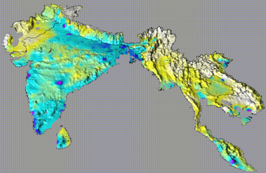
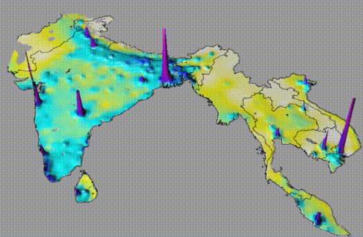
These two images show a comparison of visualization methods. Both represent population density interpolated using s.surf.tps from points located in centers of administrative units in southern Asia. Surface A shows population density mapped to color, draped over terrain. Surface B shows population density mapped to color, but also draped over a surface representing the population data rather than terrain.
 (A)
(A)
 (B)
(B)
 (C)
(C)
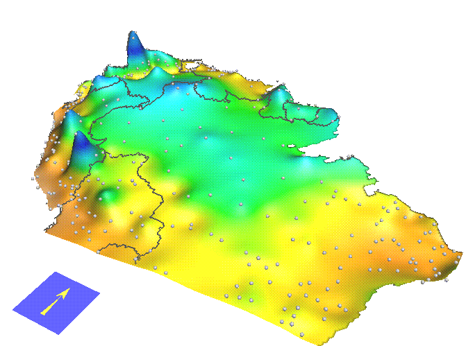
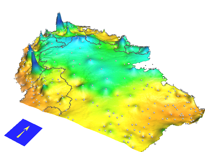
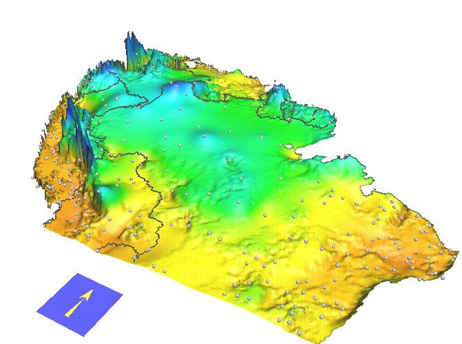
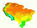
These three images show a comparison of interpolation methods. All represent precipitation in tropical South America during a given month, interpolated from data measured at scattered climatic stations. Surface A was interpolated using the spline method described above, while Surface B was interpolated using a weighted average of neighboring points. Surface C shows how the spline interpolation method can be "tuned" using another variable, in this case terrain; the resulting surface is the intersection of a trivariate spline function with the terrain model ( Mitasova et al. 1995).
 (movie - 48,842 bytes)
Animation showing monthly precipitation for one year.
 (movie - 44,210 bytes)
Animation showing monthly temperatures for one year. Temperature is represented by colors draped over terrain.
For a study on modeling of surfaces with faults using splines in GRASS see Toward a Fission Track Tectonic Image of Australia: Model based interpolation in the Snowy Mountains using a GIS by Simon Cox.
Images and animations of surfaces in this document were created using GRASS4.1 program SG3d. Programming, computations and visualization for this project was done by Environmental modeling and visualization group at U.S.Army CERL (H. Mitasova, W. Brown, D.P. Gerdes, T. Baker, I. Kosinovsky), interpolation methods were designed by Lubos Mitas at NCSA and data for South America and South Asia are courtesy Illinois Natural History Survey (Dr. Louis Iverson and Anatha Prasad).
 GMSL Modeling & Visualization