
Helena Mitasova, Lubos Mitas, Bill Brown, Irina Kosinovsky, Terry Baker, Dave Gerdes
University of Illinois and USA CERL
GRASS GIS is being expanded to support analysis of data from environmental monitoring programs such as the Chesapeake Bay Program.
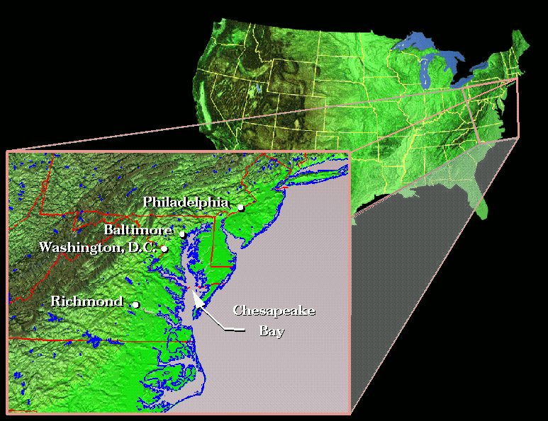 Where is Chesapeake Bay
(image - 182,000 bytes)
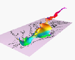
Dissolved inorganic nitrogen (DIN) is measured in the Chesapeake Bay at 43 stations at 2 or 4 depths, at each station approximately twice per month and it takes about 3 days to collect the data from all stations. Compare the sampling sites visited in February and April - the color of points in the two views of data represents the predictive error of volume interpolation which is higher in February when smaller number of samples was taken. Predictive error of interpolation can also be visualized via isosurfaces and solids.
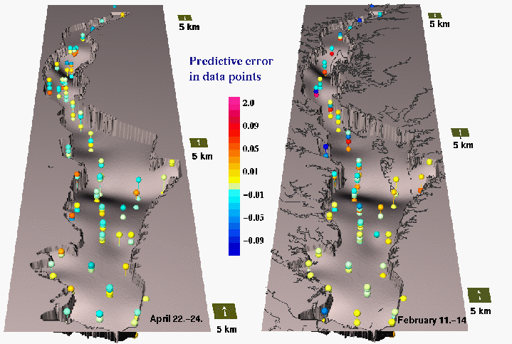
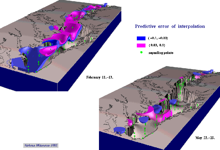
Sampling sites and predictive error of interpolation
(images - 114,000 and 44,000 bytes)
The following movies show the models of spatial and temporal distribution of DIN computed using the bivariate (Grass4.1 program s.surf.tps), trivariate (s.surf.3d) and fourvariate (s.surf.4d) regularized spline with tension .
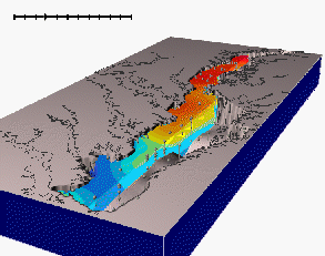
GRASS4.1 program SG3d was used to visualize the dynamics of spatial distribution of DIN concentrations at the surface layer during the year, with surface and color representing concentrations of DIN, and glyphs representing sampling sites, colored and sized according to the cross-validation error.
 animated 2D model
(movie - 140,000 bytes)
The sg4d program was used to create animations from the results of trivariate and 4-variate interpolation. The choice of the proper tension parameter for volume interpolation is very important as shown by the following movie, low tension causes overshoots and overestimation of volume values. Optimal tension and smoothing can be found by minimizing the crossvalidation error.
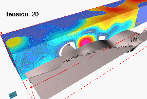 volume with changing tension
(movie - 94,000 bytes)
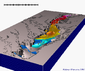
Although trivariate interpolation and volume visualization provided good representation of spatial distribution of DIN in the volume of water, the time step between the measurements was too long to meet the requirements for satisfactory animation.
 animated 3D model
(movie - 120,000 bytes)
Application of 4-variate interpolation and computation of 3D grids with 7-day step resulted in an excellent animation and proved the importance of using time as a 4-th independent variable when processing the time series of data measured in 3D space. Note the influx of high nitrogen concentrations with the influx of fresh water from the North in winter and retreat of the high nitrogen concentrations with the influx of salt water during the summer.
 4D model
(movie - 352,000 bytes)
To learn more about the visualization tools used in this project see Visualization with GRASS GIS and read a paper Multidimensional dynamic cartography by Mitasova et al. 1994. Programming, computations and visualization for this project was done by Environmental modeling and visualization group at U.S.Army CERL (H. Mitasova, W. Brown, D.P. Gerdes, T. Baker, I. Kosinovsky), interpolation methods were designed by Lubos Mitas at NCSA and data are courtesy Chesapeake Bay monitoring program. You can find more about Chesapeake Bay related research at Center for Coastal Physical Oceanography , and UMCP Libraries .
 GMSL Modeling & Visualization