
TERRAIN ANALYSIS AND EROSION MODELING
HELENA MITASOVA AND LUBOS MITAS
University of Illinois at Urbana-Champaign
Copyright © 1998 Helena Mitasova, GMS Laboratory, University
of Illinois at Urbana-Champaign
For requests to use this material or its parts please contact:
helena@gis.uiuc.edu
References:
Mitasova, H., L. Mitas, 1993, Interpolation by regularized spline
with tension : I. Theory and implementation.
Mathematical Geology 25, p. 641-655.
Mitasova, H., J. Hofierka, 1993, Interpolation by regularized spline
with tension : II. Application to terrain modeling and surface geometry
analysis.
Mathematical Geology 25, p. 657-669.
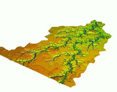
Topographic parameters representing the geometric properties of
terrain surface are important for many applications related
to environmental modeling and land use management.
GRASS programs s.surf.tps,
v.surf.tps and r.resample.tps allow users
to compute several topographic parameters simultaneously
with interpolation from point, vector or raster elevation data.
The program computes a mathematical model of the surface
and its first and second order derivatives
using regularized spline with tension .
Derivatives are then used in the programs for computation of slope,
aspect, profile, tangential and mean curvature as described in
Mitasova and Hofierka 1993 .
The following images show an example of results from s.surf.tps.
Flow related topographic parameters needed for hillslope erosion
modeling are computed by flow tracing program
r.flow, the combined grid-vector
flowtracing algorithm used in this program
is described in Mitasova and Hofierka 1993
and Mitasova, Mitas et al. 1995).
Topographic potential of landscape for erosion/deposition can be computed
based on the unit stream power theory as a change in sediment transport
capacity (see Mitasova, Hofierka et al. 1995).
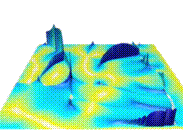 Flow (movie - 68,164 bytes)
animated gif
This animation created by r.flow and SG3d,
shows a simple simulation of water flow as it changes during a rainfall event.
For simplicity, the distribution and rate of rainfall remains constant.
The depth of water is visualized as a surface.
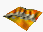
animated gif
This animation shows how sediment transport capacity changes over time due
to changes in water flux during a rainfall event.
Again, the distribution and rate of rainfall is
kept constant and the sediment transport capacity
is visualized as a surface for better quantitative comparisons.
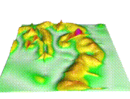
animated gif
This simple animation created by r.reclass and SG3d,
shows how the landscape will be changing when a proposed
water reservoir is filling with water.
 insolation during the winter solstice(animated gif)
The animation created by r.sun (developed by Jaro Hofierka) and SG3d
shows dynamics of insolation during the summer and winter.
Images and animations for this document were created using the
GRASS4.1 program SG3d.
Programming, computations and visualization
for this project was done by
Environmental modeling and visualization group
at U.S.Army CERL (H. Mitasova, W. Brown, D.P. Gerdes, T. Baker, I. Kosinovsky),
interpolation methods were designed by
Lubos Mitas at NCSA, flowtracing program was developed by Jaro
Hofierka, Maros Zlocha from Comenius University, Bratislava,
Slovakia,
and Joshua Caplan from
University of Illinois,
data are courtesy Illinois Natural History Survey (Dr. Louis Iverson).
This work was partially supported by DOD Strategic Environmental
Research and Development Program (
SERDP
), Conservation Pillar,
project: Digital Elevation Modeling and Erosion Simulation.
 GMSL Modeling & Visualization
Home Page
 Sediment transport capacity (movie - 252,876 bytes)
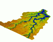 Lake Filling(movie - 36,138 bytes)
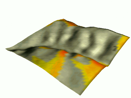 insolation during the summer solstice(animated gif)
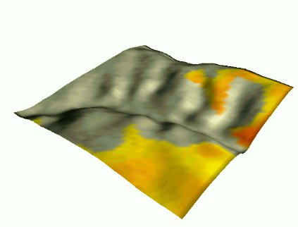 insolation during the winter solstice(animated gif)