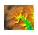
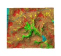
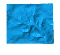
Finding, importing, integrating and processing the data necessary for erosion modeling can be a time consuming task. Therefore a well maintained, consistent GIS database makes data preparation easy and fast. The distributed erosion modeling presented in this tutorial requires raster data. The following data layers are essential for estimating the overland flow erosion (click on the link for more details about the data sources and processing):
 Elevation
data should be available as a raster DEM, with vertical precision in cm.
If a raster DEM is not available, contours or points can be interpolated to create the DEM.
Elevation data are used to compute slope, direction of flow, and upslope area.
Elevation
data should be available as a raster DEM, with vertical precision in cm.
If a raster DEM is not available, contours or points can be interpolated to create the DEM.
Elevation data are used to compute slope, direction of flow, and upslope area.
 Land cover
data can be in the form of a vegetation, land cover or land use map, preferably
as a raster file. If raster data is not available, polygon areas can be transformed to raster at desired
resolution. Land cover data are used to estimate the C-factor
and as a basis for creating new land use alternatives.
 Soils
data are generally available as polygons and have to be transformed to raster. If soil
samples are available, spatial interpolation is used to compute the raster representation.
Soil data are used to derive the K-factor, which is usually included within the related
database.
 Rainfall
data are available in the form of isoline maps for R-factor or from
databases used for RUSLE. For field and small watershed scales, a single value is
sufficient;
for regional modeling the rainfall factor should be given as raster map.
For each data layer we provide some general information about data sources.
The task of integrating data from different sources can be complex if the coordinate
system and projection are different. While ArcGIS provides on-the-fly projection transformation,
this can be done only for data that have the appropriate metadata available in
the Arc database. A
good understanding of coordinate systems, projections and datums is necessary to perform
the data integration effectively.
 We include here some simple
datasets and results, in ASCII format for import into GIS.
For more detailed modeling, the following data can be useful (some may already be included with land use):
These additional data layers can be used in the GIS along with the land use map layer for derivation of C-factor. Alternatively, a prevention (P-factor) map layer may be derived if field validation data are available. In this tutorial, we use a constant 1.0 for prevention.
|
|