
Court Creek Pilot Watershed |
| Where is Court Creek? |
| Geographic Overview |
| Issues |
| Data Sources |
| Research |
| Run Models |
| Links (send us yours!) |
| Participants |
| CFAR SRI-IT |

Research for Pilot Watersheds
WORKPLACE DOCUMENT
University of Illinois at Urbana-Champaign
Modeling
-
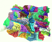
Watershed-based hydrologic and sediment transport, ISWS -
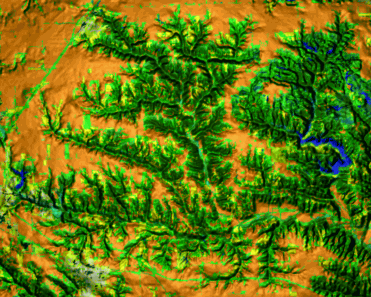
Distributed modeling of erosion by overland flow

Monitoring
To assess the impact of increased implementation of conservation practices the monitoring program is based on a paired watershed approach (e.g., Court Creek with Haw Creek as a reference watershed)
- Biological and stream habitat at upper and lower subwatersheds: INHS
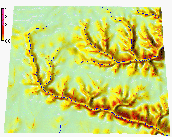
(map of monitoring sites locations)
- Fish
- Banthic Macroinvertebrates
- Habitat assessment
- Hydrologic and water quality: ISWS (map of monitoring sites locations)
- Hydrologic measures: water level, streamflow, discharge
- Nutrient concentration: Nitrate-N, Ammonia, Phosphate
- Suspended sediment concentration
This project is supported by C-FAR IT-SRI and Illinois Department of Natural Resources
 GMSL Home Page
 GMSL Modeling
& Visualization Home Page
GMSL Modeling
& Visualization Home Page
Contacts
Helena Mitasova (GMSLab)
helena@gis.uiuc.edu
Bill Brown (GMSLab)
brown@gis.uiuc.edu
Lubos Mitas (NCSA)
lmitas@ncsa.uiuc.edu