
Court Creek Pilot Watershed |
| Where is Court Creek? |
| Geographic Overview |
| Issues |
| Data Sources |
| Research |
| Run Models |
| Links (send us yours!) |
| Participants |
| CFAR SRI-IT |

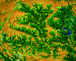
Court Creek Pilot Watershed - Geographic Overview
- Text
- 2D and 3D maps, vrml
- topographic map for Court Creek
- 3D views of locations along the Middle Creek (link-in photos)
- ISIS maps
- thematic maps (terrain+parameters, geology, soils, land use, wetlands/parks, pollution, average climate...)
- images/photos ( we can get them from the county)
Contacts
Helena Mitasova (GMSLab)
helena@gis.uiuc.edu
Bill Brown (GMSLab)
brown@gis.uiuc.edu
Lubos Mitas (NCSA)
lmitas@ncsa.uiuc.edu