
Court Creek Pilot Watershed |
| Where is Court Creek? |
| Geographic Overview |
| Issues |
| Data Sources |
| Research |
| Run Models |
| Links (send us yours!) |
| Participants |
| CFAR SRI-IT |

Data Sources
- Data from the GMS Lab
( GRASS/ARC raster/grid, metadata, vrml; Court Creek and its reference paired
watershed Haw Creek)
- Watershed boundary - mask
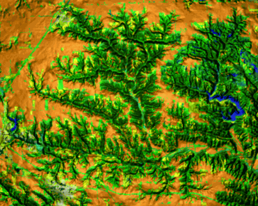
- Digital elevation model
- Digital raster quadrangles (see sample draped over DEM)
- Slope
- Aspect
- LS-factor
- Land use 1993
- C-factor
- annual soil loss estimated by modified USLE
- Data from Illinois Stream Information System (shape files, numerical data)
- Streams
- Monitoring stations
- Land cover along streams
- Data available on the Interenet
- Data available on Internet - organized and commented for hydrologic modeling
- Illinois Natural Resources Geospatial Data Clearinghouse
- Illinois EPA water quality report (305b)
-
USGS 7.5 minute DEMs (used to create the DEM available above):
appleton
galesbg
oneida
victoria
wataga
wmsfield
- NRCS Technical Resources
-
A
EPA Surf Your Watershed page for Spoon River watershed
(USGS Cataloging Unit: 07130005) - Upper Midwest Environmental Sciences Center (USGS)
- USGS Aerial Photos
- Monitoring and field data (link to research for overview of what is being
collected, link here when/if the data become available)
- EcoWatch (currently no sites at Court Creek or Haw creek)
- Ambient water quality (EPA)
- Long Term Resource Monitoring Program, Critical Trends Assessment Program, (INHS)
- Sheet, rill, gully and streambank erosion inventory (NRCS)
- Conservation 2000 Transect data (?) (NRCS?)
- Water and atmospheric resources modnitoring program (ISWS)
- Waterfowl cencus, fisheries surveys, EcoWatch volunteer stream monitoring program (IDNR)
- Data under development
- New 10m resolution DEM (USGS, 2000)
- New 10m resolution land use (SPOT)
- Digital soil map (January 2000, NRCS)
- Historic data
- Suggested standard data set for watershed planning group (link)
Potential data sources
- LIDAR data for Illinois river watershed
companies producing LIDAR data:
Optech, Canada
TerraPoint
LIDAR information