|
|
|||||
|
Using
Soil Erosion Modeling for Improved Conservation Planning: |
|||||
|
|
|||||
|
Using
Soil Erosion Modeling for Improved Conservation Planning: |
|||||
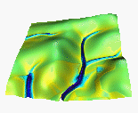
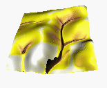
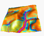
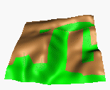
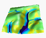
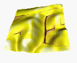
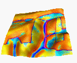
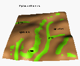
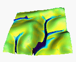
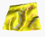
Simulated water depth, sediment flow rate and net erosion/deposition for the original, new (sustainable), and computer designed land use, for the time of the year when the agricultural land (brown) is bare and grass cover (green) is well developed.
| Land cover | Water | Sediment flow | Erosion/deposition | |
| A. Traditional land use (21% grass) | 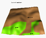 |
 |
 |
 |
| B. New sustainable land use (41% grass) |
 |
 |
 |
 |
| C. SIMWE based land use (19% grass) |
 |
 |
 |
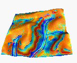 |
Comment: Both B and C hold more water, reduce the max. sediment flow rates and max erosion rates.
Example 2.
Simulated sediment flow rate and net erosion/deposition for a field before and after installation of a protective grassway. If difference in the speed of water flow between the bare field and grassway is large, erosion around the grassway occurs. If this difference is reduced e.g. by increasing the roughness in the bare field, erosion around grassway disappears.

Image table with land use pattern, sediment flow and net erosion/deposition before and after grassway installation
Water depth, sediment flow and net erosion/deposition pattern for spatially variable land cover conditions were simulated using the distributed, process-based model SIMWE described in the following papers:
|
|


