|
|
|||||
|
Using
Soil Erosion Modeling for Improved Conservation Planning: |
|||||
|
|
|||||
|
Using
Soil Erosion Modeling for Improved Conservation Planning: |
|||||
| Regional/installation ~1000 sq km |
 |
Assessment
of averaged pattern of erosion risk
|
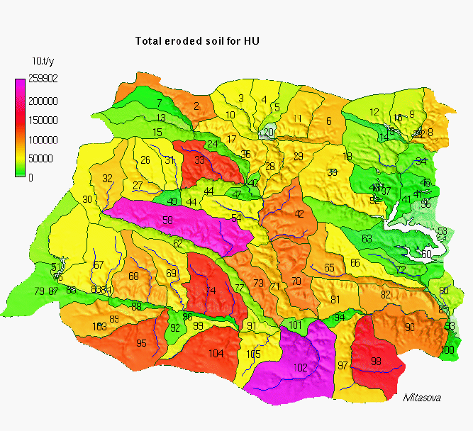 |
identification of high risk subwatersheds |
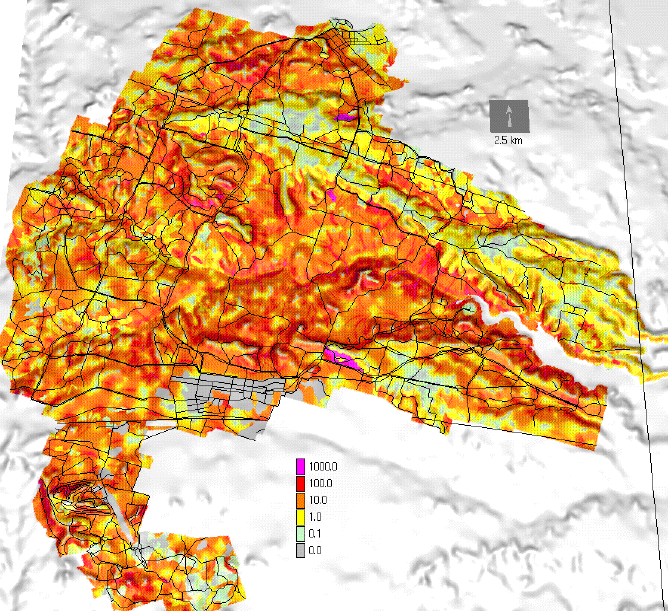
| Landscape/training
area ~100 sq km |
 |
Identification of hot spots |
  |
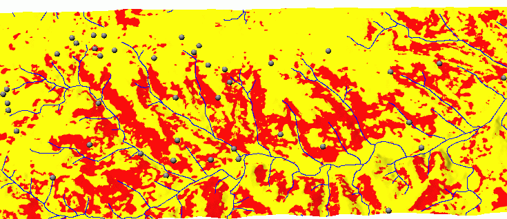
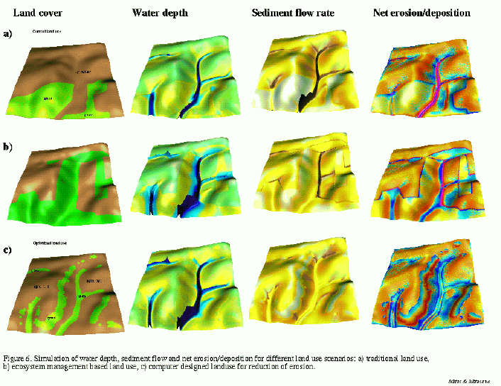
Location of depositional (left) and major concentrated flow (right) areas |
|
|
planning location of conservation measures |
| Field/small
watershed ~1-10 sq km, |
 |
detailed erosion and deposition pattern and effects of conservation measures |
 |
detailed impact of erosion on roads |
|
|


