Erosion and Sediment Control: Modeling with GIS
Projects
Publications

Geoinformation Science, when combined with field observations and process-based modeling can help us to better understand spatial patterns of soil erosion, sediment transport and deposition. We can use this knowledge to plan more effective erosion prevention and sediment control measures and protect our water resources.
The methods and tools that we are using and developing are demonstrated by the following projects:
 GIS-based Soil Erosion and Deposition Modeling Tutorial
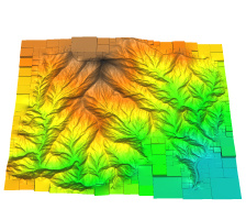
 Centennial Campus: Impact of development
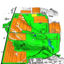 Lake Wheeler: Experimental Farm
 NCSU Veterinary School : Impact of new construction
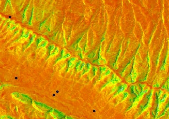
 Balsam Mountain
Soil Erosion Modeling for Conservation Planning: A GIS-based Tutorial
Links
EPA NPDES: Construction Site Storm Water Runoff Control
Part of National menu of BMPs, available as pdf here
http://cfpub.epa.gov/npdes/stormwater/menuofbmps/pdf/small_files/sec-4_new.pdf,
each measure has description, illustration, effectiveness and cost info.