|
|
|||||
|
Using
Soil Erosion Modeling for Improved Conservation Planning: |
|||||
|
|
|||||
|
Using
Soil Erosion Modeling for Improved Conservation Planning: |
|||||
Troubleshooting
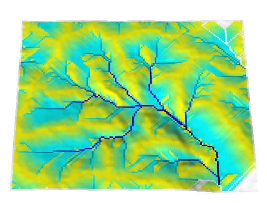
Flow accumulation map has many straight lines.
The problem can be reduced by increasing the grid cell size (decreasing resolution), however, some detail will be lost. A better, although more time consuming, solution is to use one of the ArcView flow tracing or hydrologic modeling extensions with a D-infinite or multiple flow paths routing algorithm.
|
|


