|
|
|||||
|
Using
Soil Erosion Modeling for Improved Conservation Planning: |
|||||
|
|
|||||
|
Using
Soil Erosion Modeling for Improved Conservation Planning: |
|||||
Troubleshooting
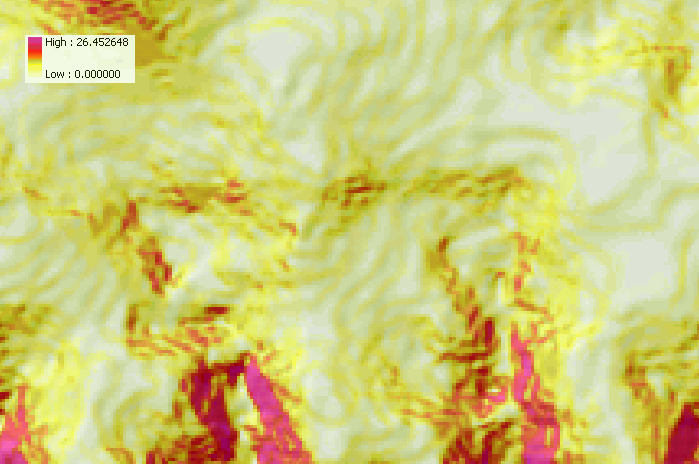
Slope Map Has Contour-like Pattern
Using smoothing techniques during interpolation of the DEM and thinning the sample points along the contour will reduce the terracing effect somewhat.
|
|


