|
|
|||||
|
Using
Soil Erosion Modeling for Improved Conservation Planning: |
|||||
|
|
|||||
|
Using
Soil Erosion Modeling for Improved Conservation Planning: |
|||||
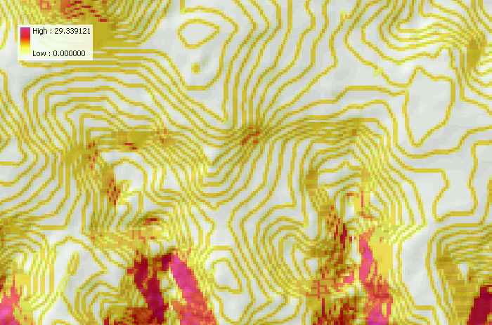
Troubleshooting
Slope Map Has Contour-like Pattern
A DEM interpolated from dense points along contour lines may generate a slope map such as this, which overestimates flat areas and contains lines along the contours of artificial drops, forming terraces.
|
|


