|
|
|||||
|
Using
Soil Erosion Modeling for Improved Conservation Planning: |
|||||
|
|
|||||
|
Using
Soil Erosion Modeling for Improved Conservation Planning: |
|||||
60 ft stream buffer, forest on
slopes > 10%
Soil
Erosion/ Deposition
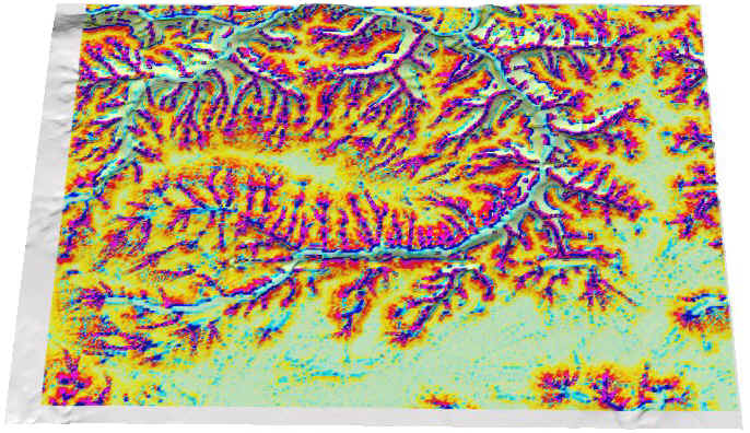
15 [1000 t/ay] Excess
[1000t/ay]
|
|


