|
|
|||||
|
Using
Soil Erosion Modeling for Improved Conservation Planning: |
|||||
|
|
|||||
|
Using
Soil Erosion Modeling for Improved Conservation Planning: |
|||||
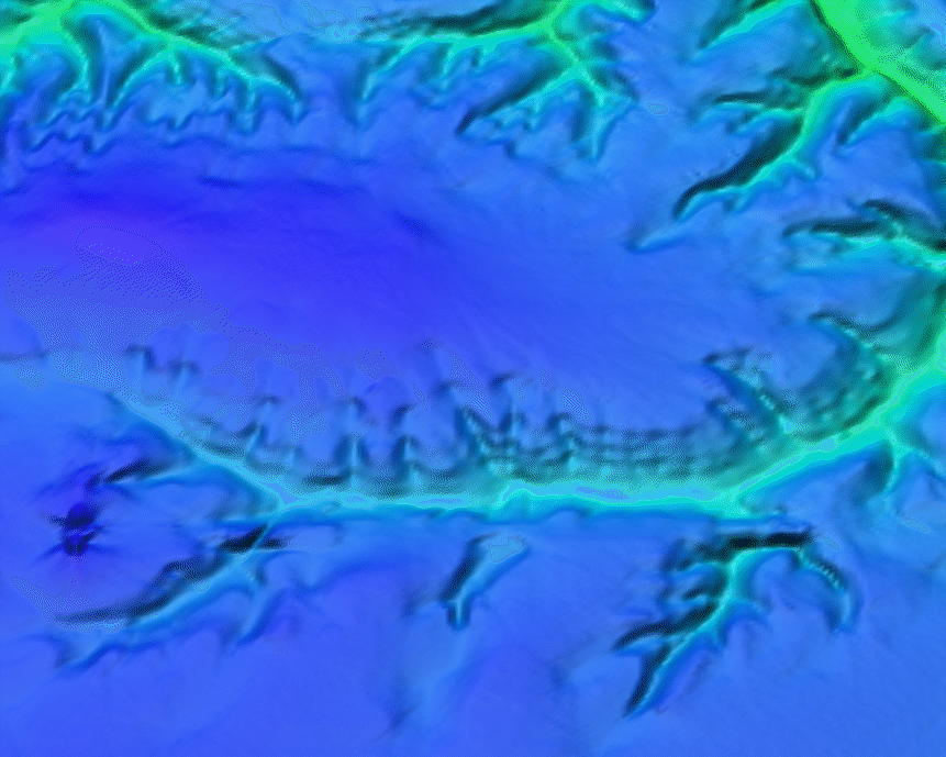
The elevation data represented here was produced by the USGS at 10 meter grid size from contour data that had previously been used to produce the 30 meter resolution DEMs. A few new problems due to the TIN-based interpolation method were observed, such as waves along contours in steep areas, and noise in flat areas, leading to noisy and inconsistent contours and artificial dams in valleys due to triangulation.
|
|


