

WORKPLACE DOCUMENT
http://www2.gis.uiuc.edu:2280/modviz/protected/hohen/hoh4.html
Helena Mitasova, Lubos Mitas, William M. Brown
University of Illinois at Urbana-Champaign
Cost effective land maintenance and rehabilitation at military installations requires identification of critical areas which should be targeted for erosion prevention. High resolution, process-based simulations provide valuable tools for assessing the current situation and predicting erosion and deposition patterns for various land management conditions.
This document presents application of semi-empirical and process-based erosion simulation tools to evaluation of erosion and deposition at an installation, illustrates modeling at different resolutions and compares the input data and results with the 1989 study.
Methods and algorithms used for topographic analysis, erosion modeling and visualization are described in the following papers
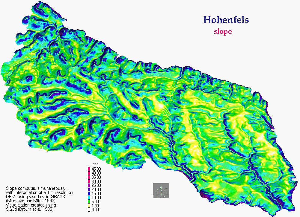
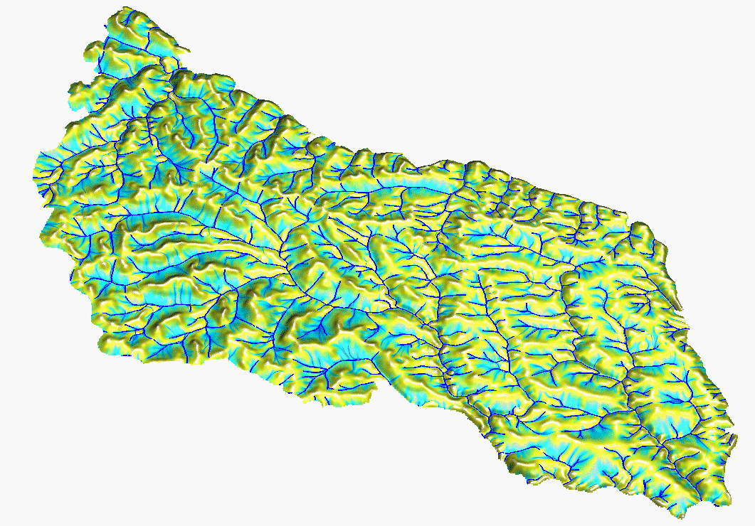
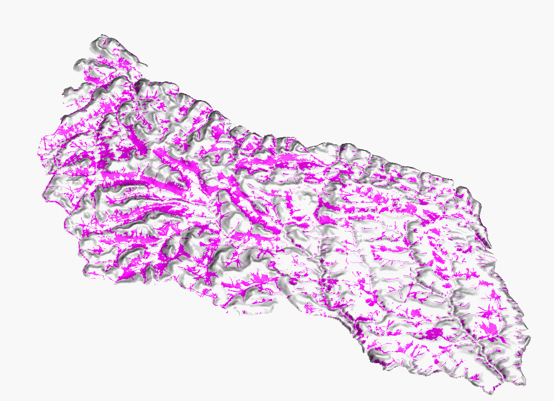
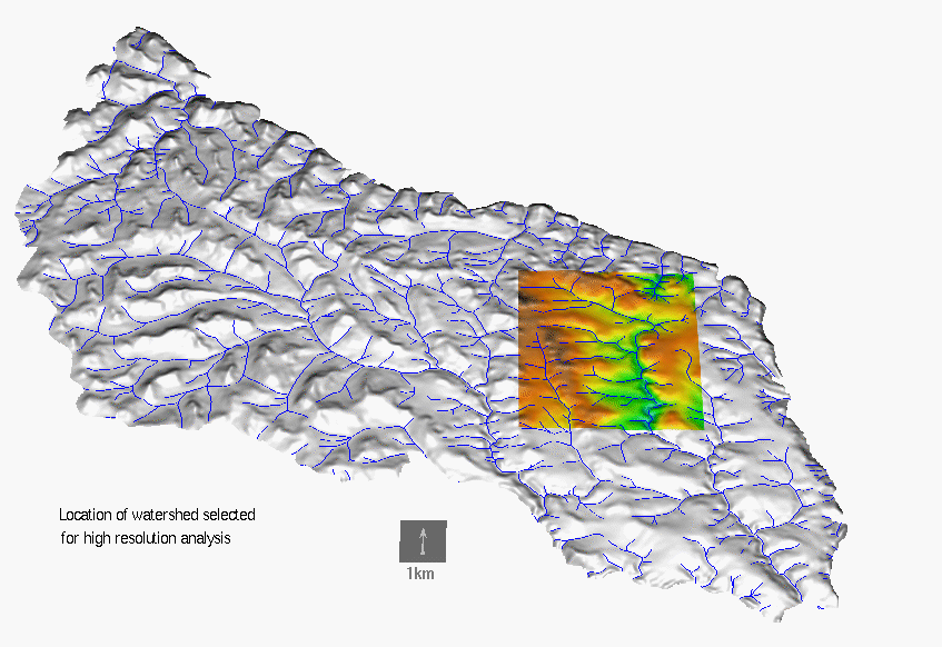
Computation of DEM and topographic analysis is a crucial component of data preparation for erosion modeling. For this study, 10m resolution DEM was interpolated from 5m contours using the RST method with simultaneous topographic analysis including the computation of slope, aspect and curvatures. For a watershed in eastern part of the installation we have computed a 2m resolution DEM (see section 3.2.2) from the 5m contours and for a small subarea of this watershed we have computed 2m resolution from 1m contours for multiscale simulations. For comparison, we include a sample of 10m DEM derived from remote sensing techniques as well as a recently obtained 4m resolution DEM. See http://www2.gis.uiuc.edu:2280/modviz/protected/hohen/hoh1.html for more details and maps on topographic analysis.
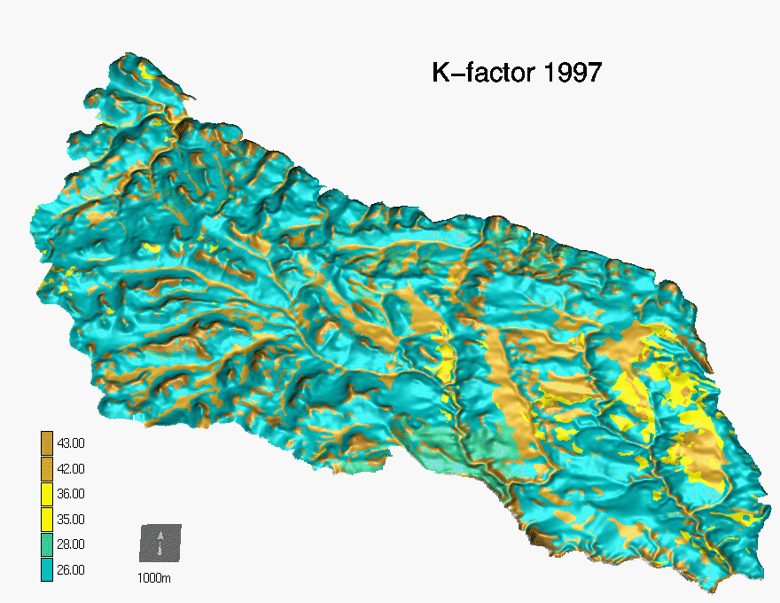
Input parameters:
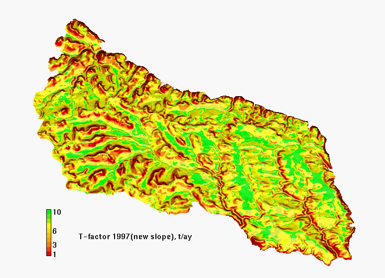
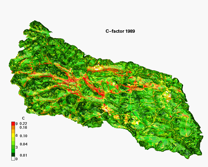
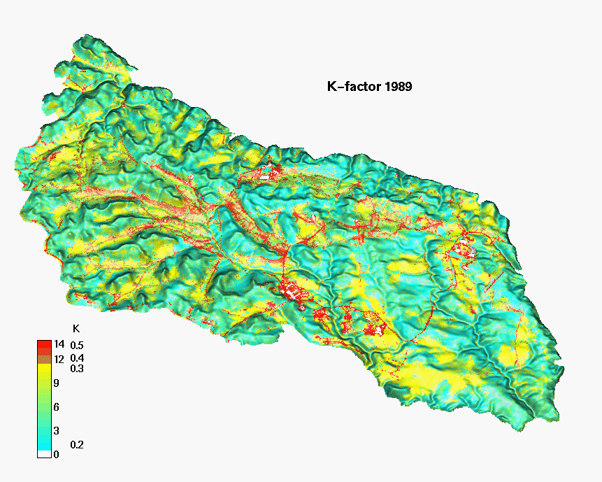
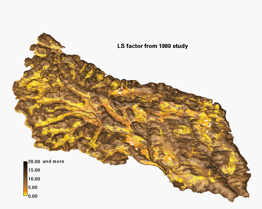
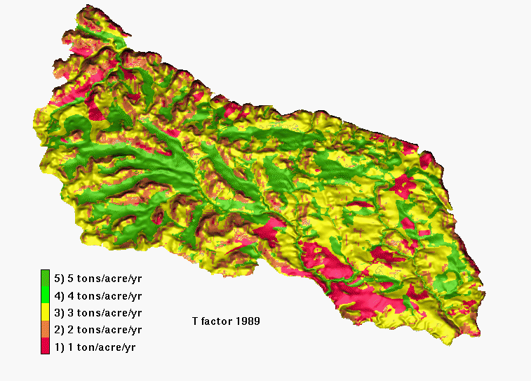
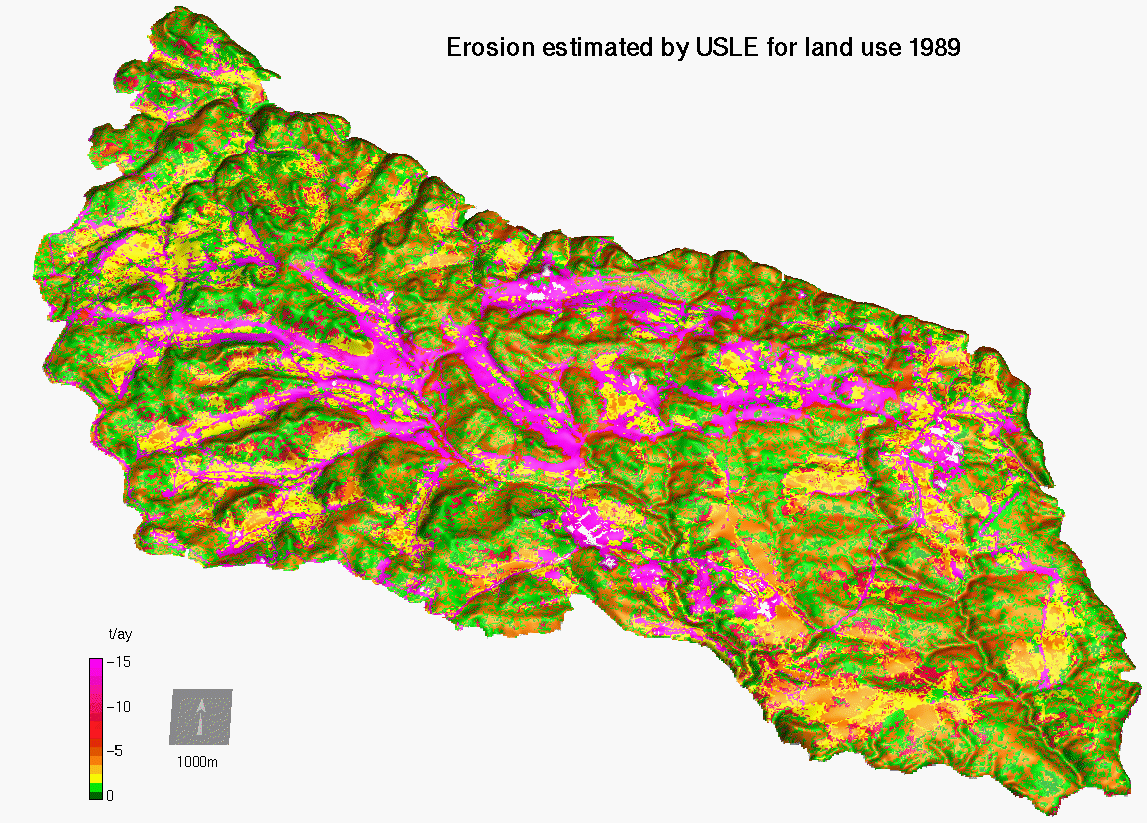
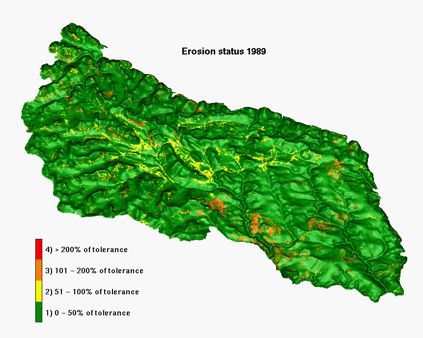
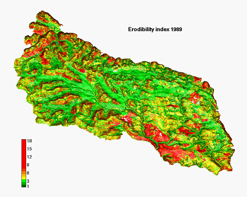
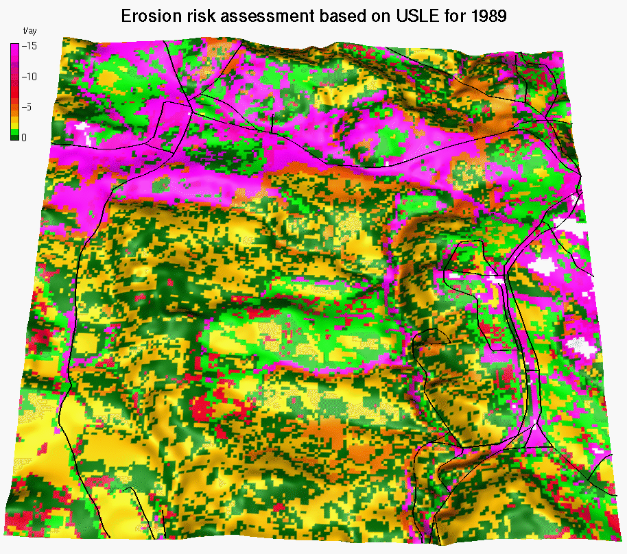
For comparison, we also present the input parameters used in the 1989 report:
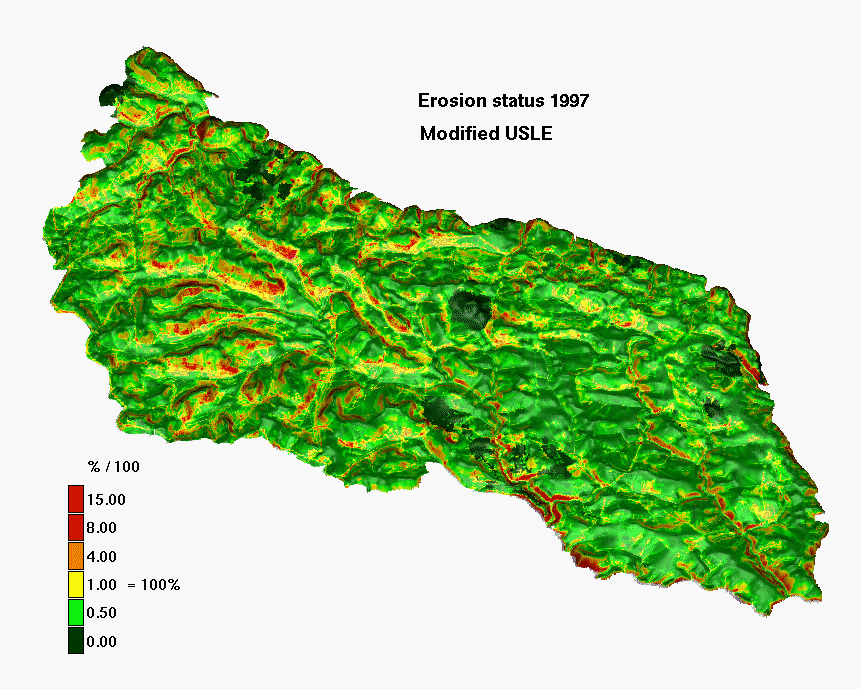
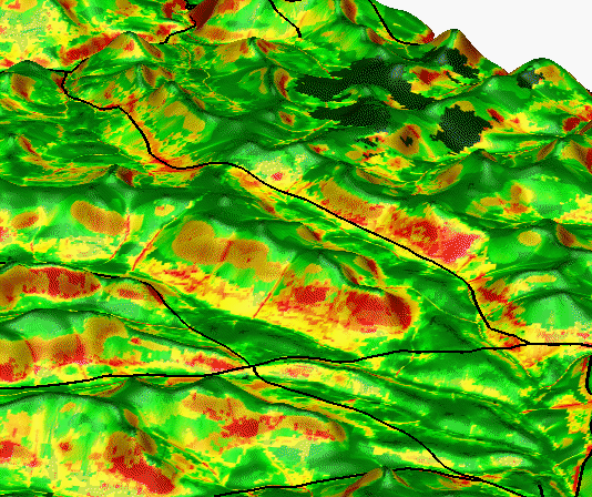
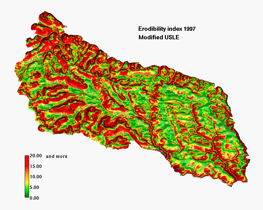
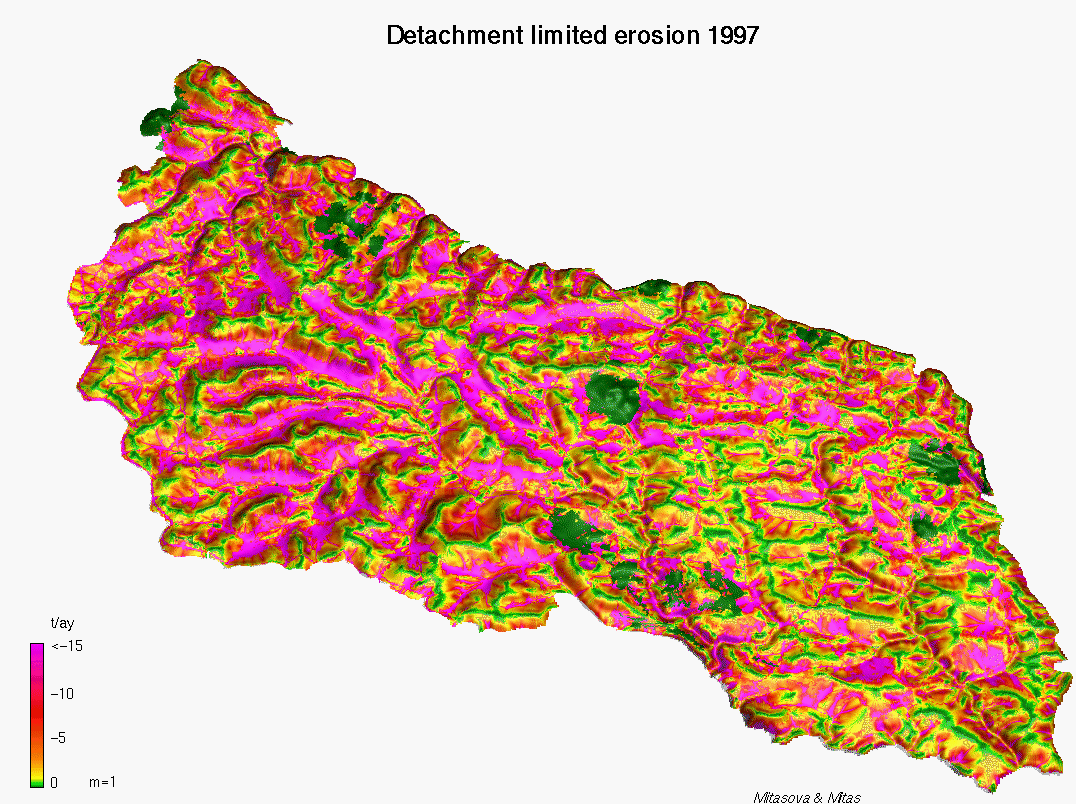
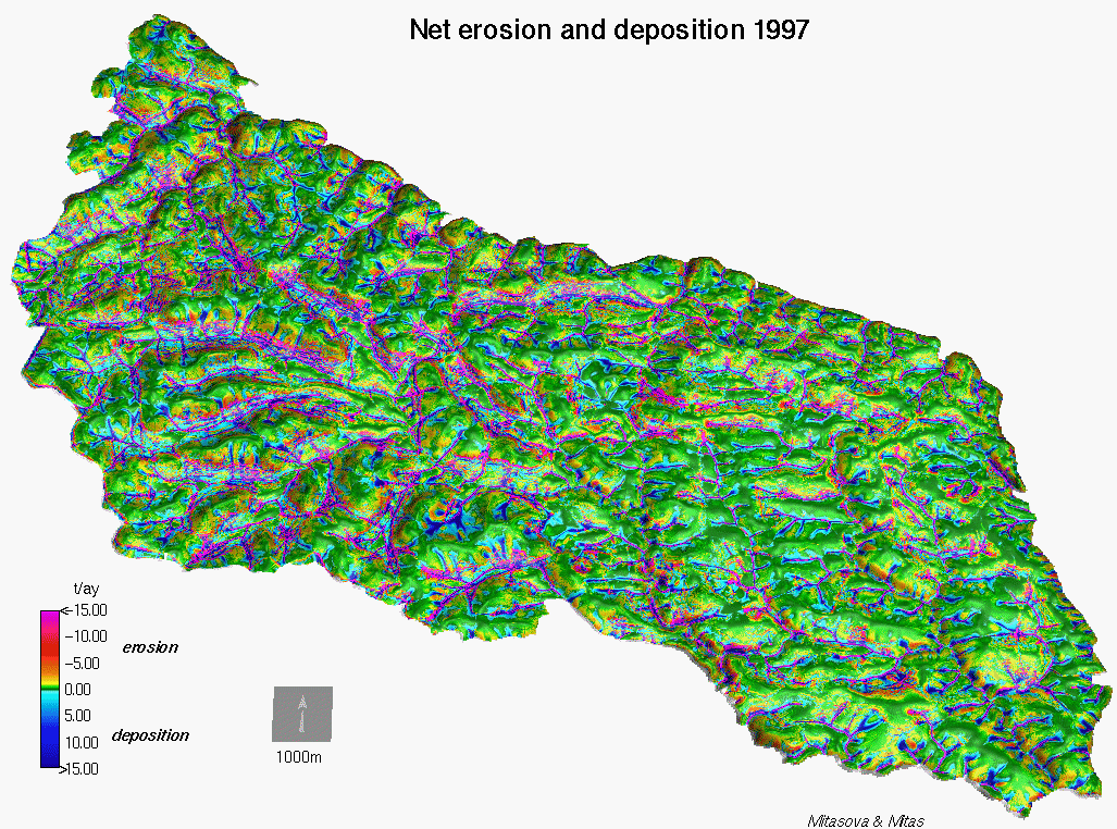
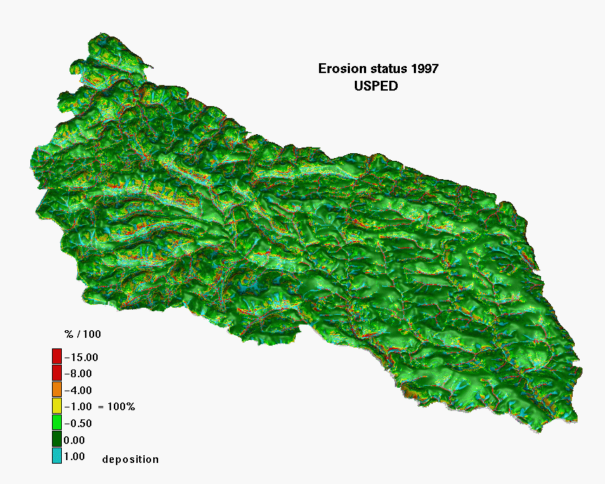
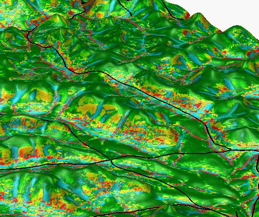
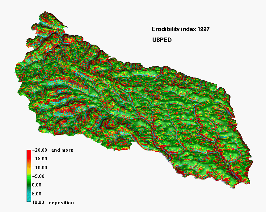
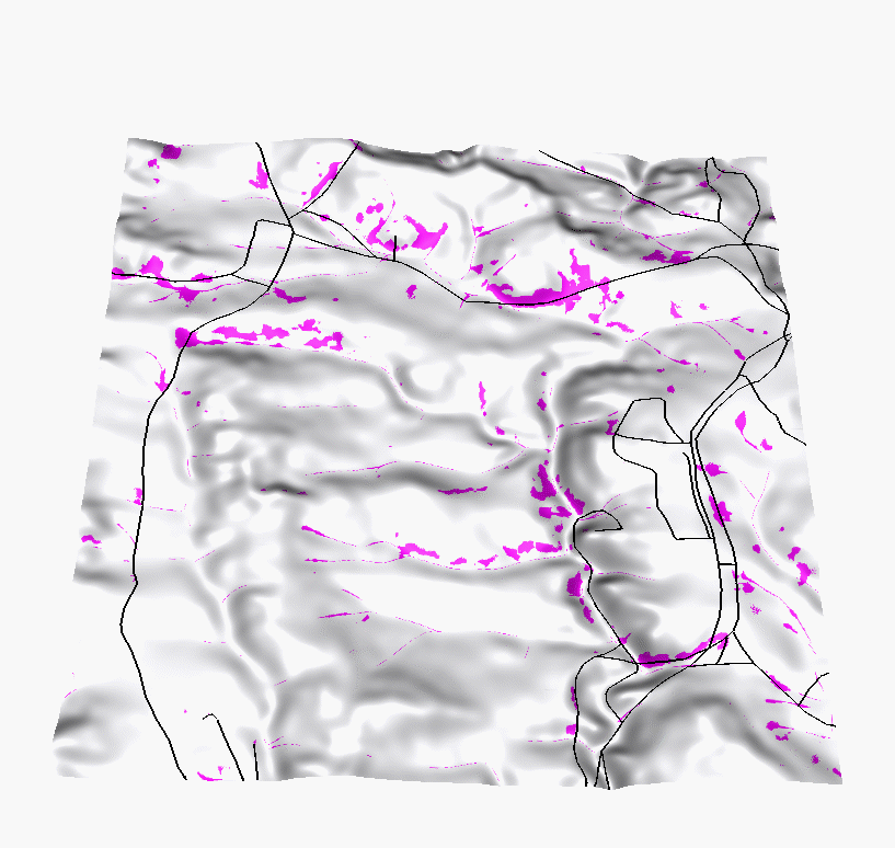
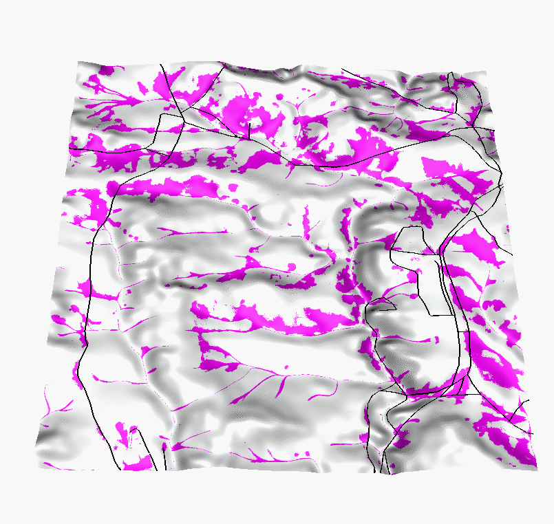
Results:
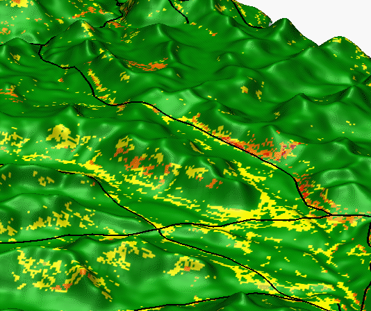
Location of the subregion
selected for a high resolution and multiscale study 1997
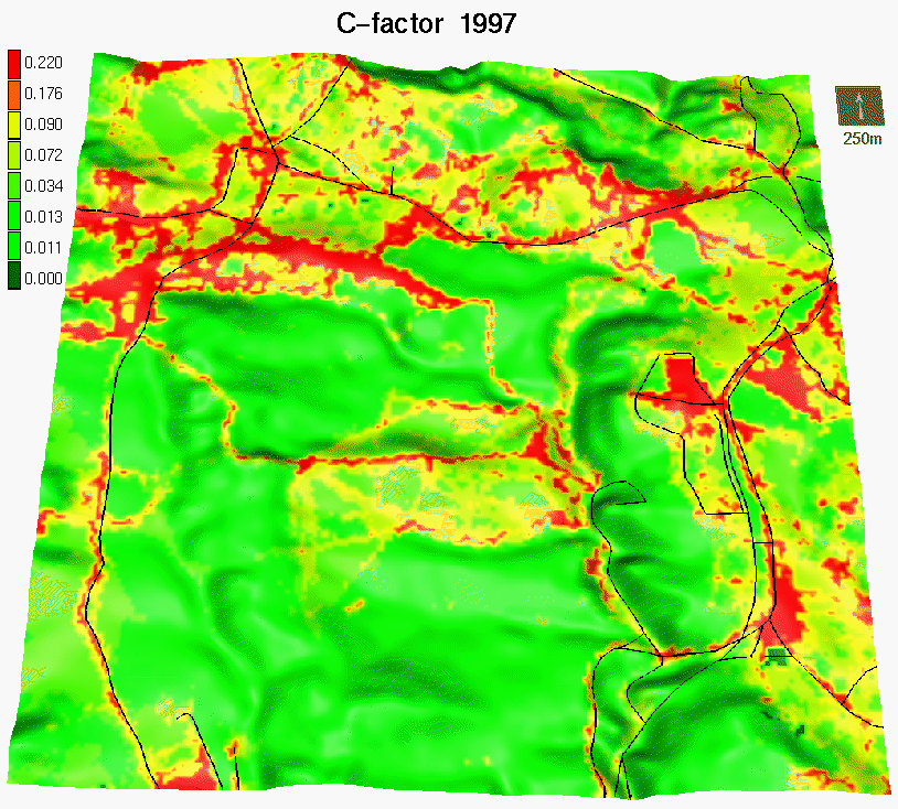
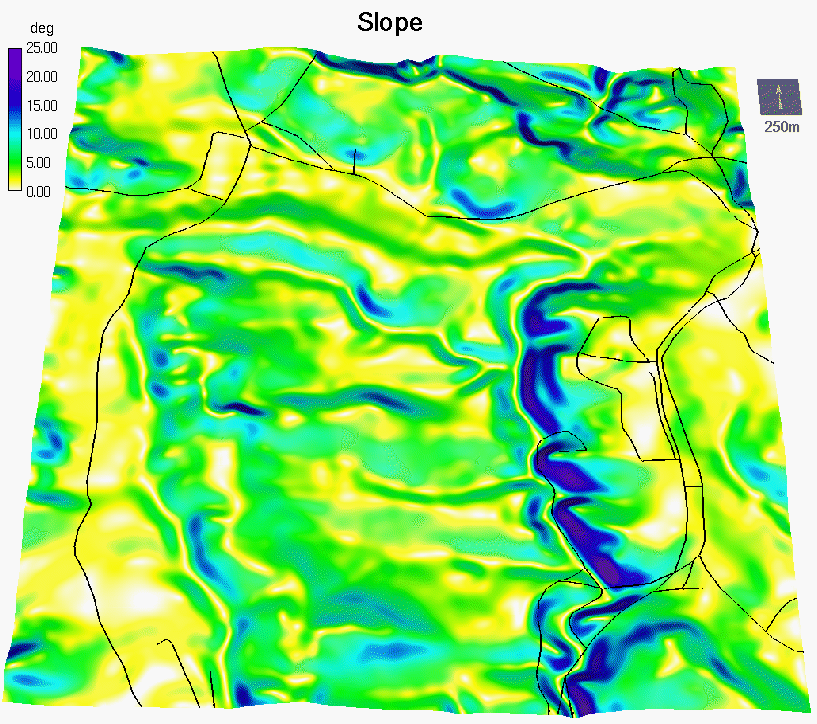
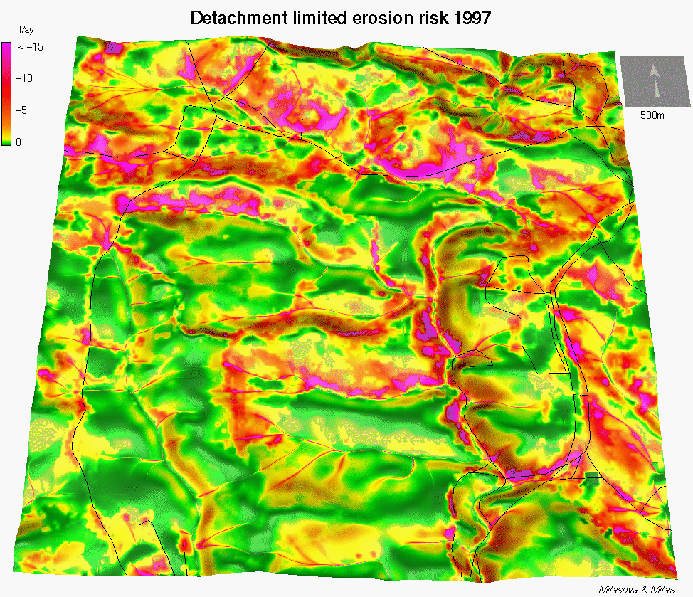
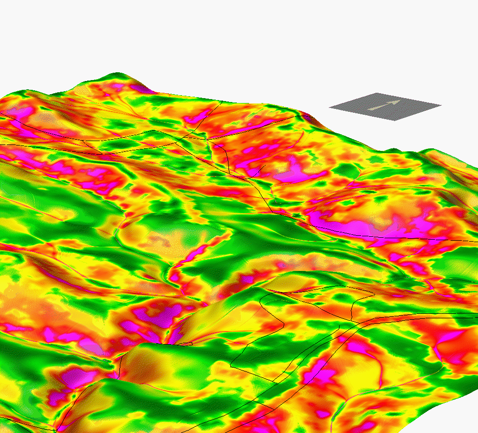
Input parameters:
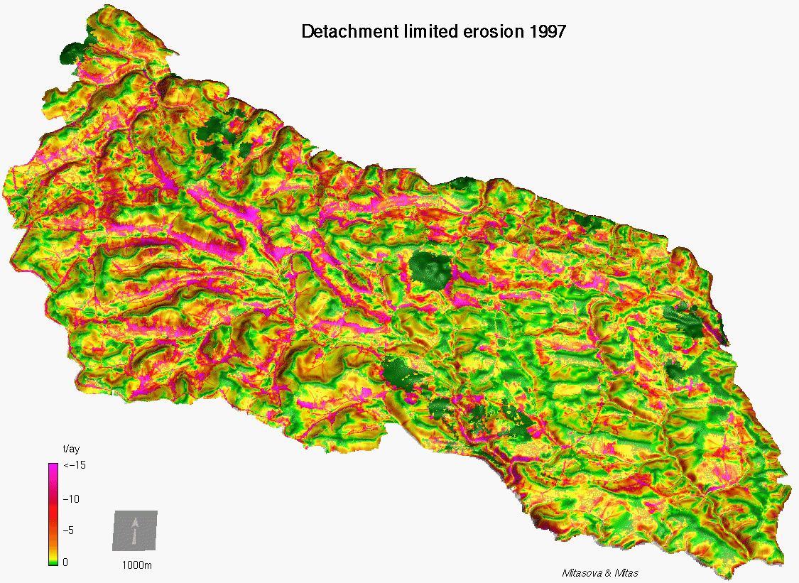
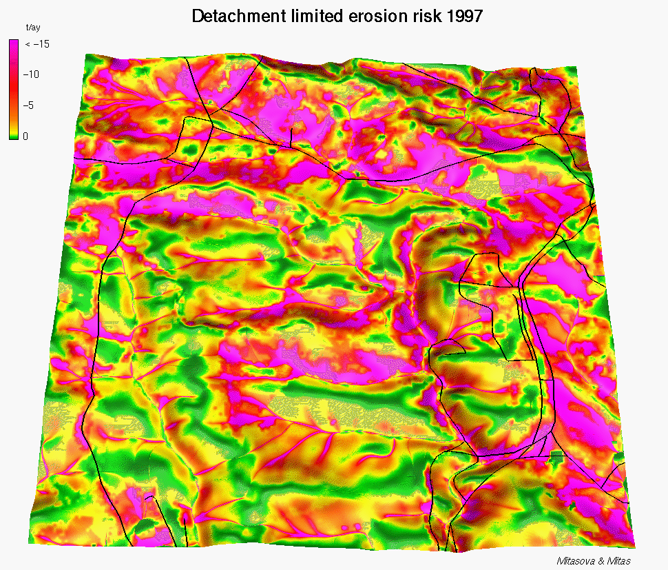
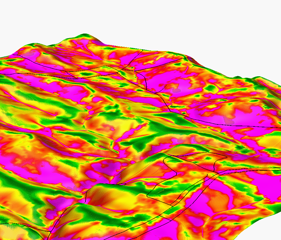
Results:
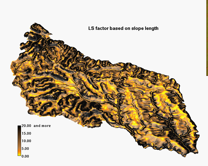
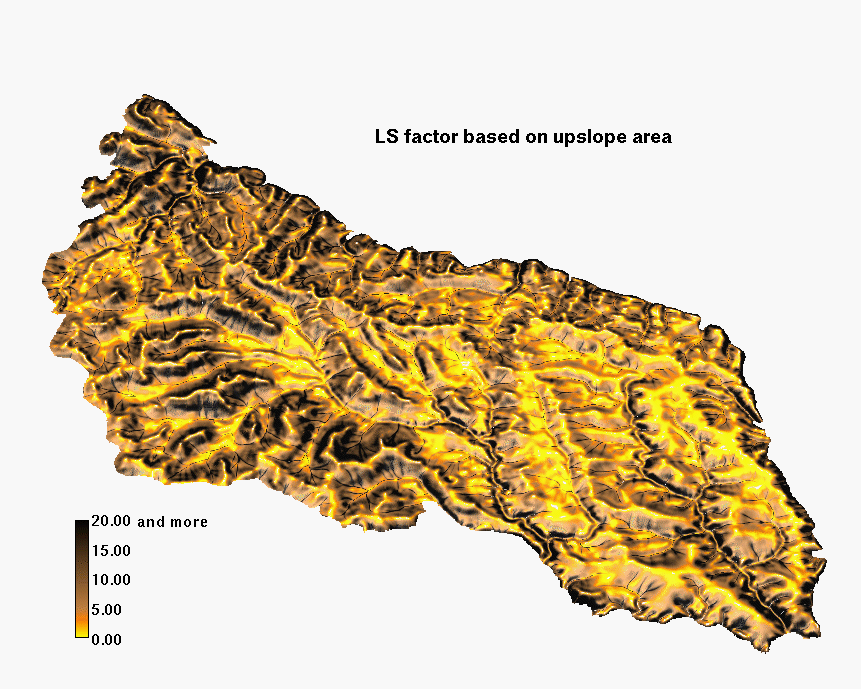
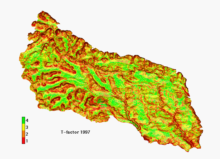
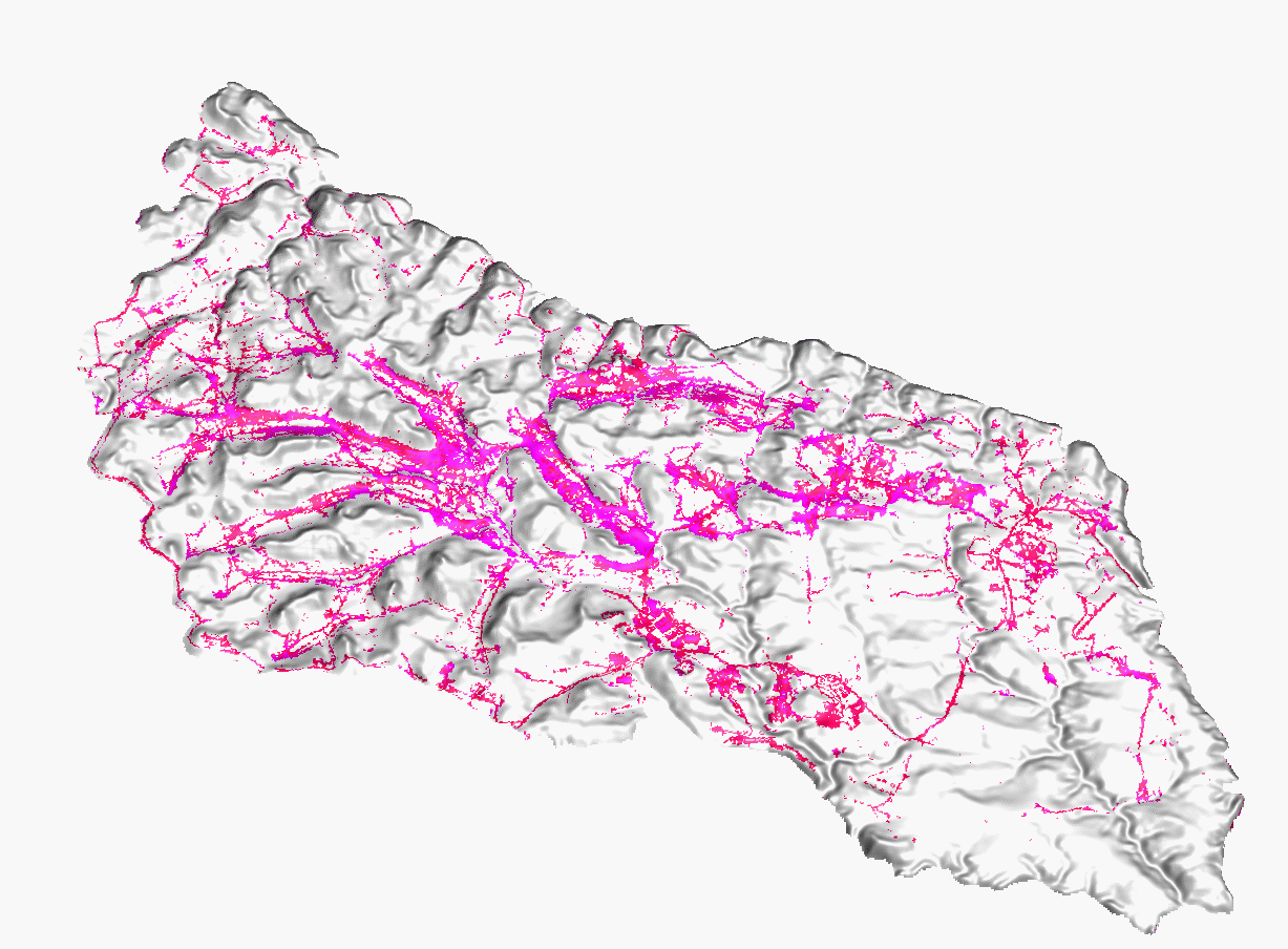
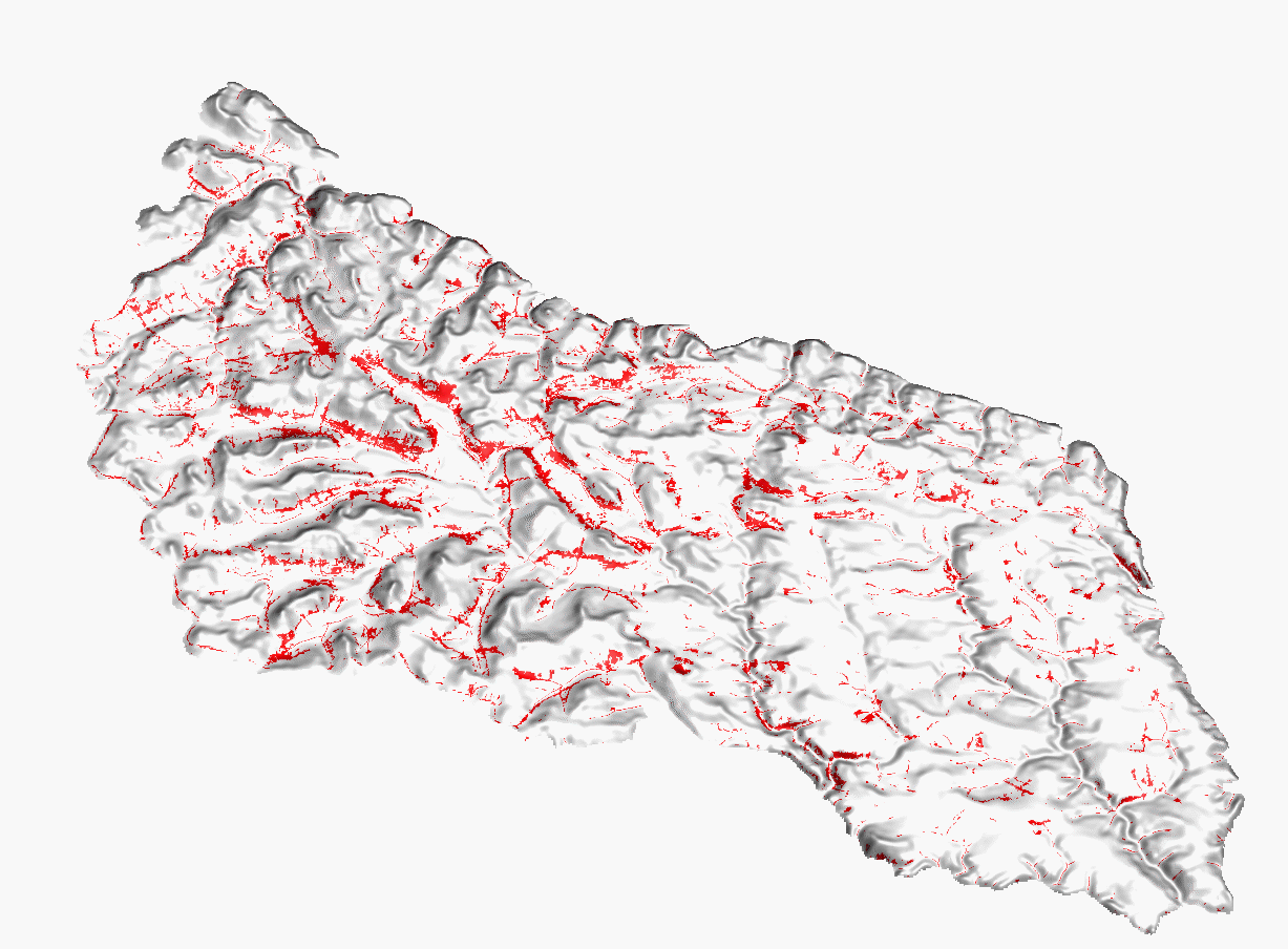
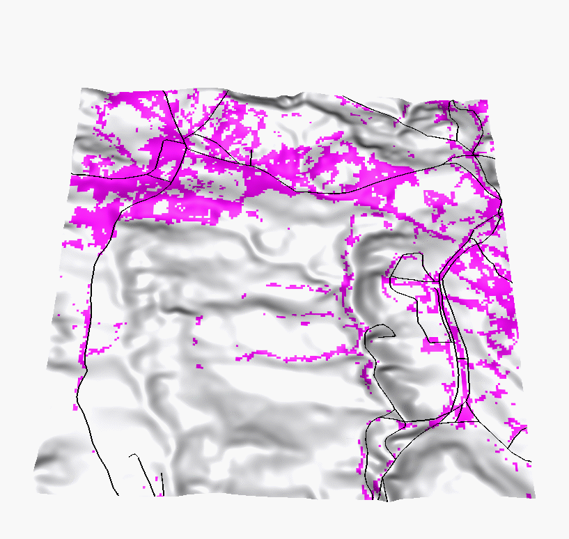
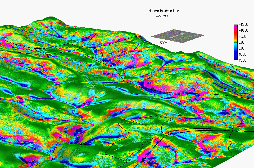
In spite of the fact that the spatial accuracy of the erosion risk assessment is limited by the resolution of cover data, (which is 20m, while the DEM is 10m and 2m resolution), the high resolution elevation data and new models allow us to predict erosion risk areas with greater detail, identify the high risk areas with concentrated water flow which were missing in results from the previous study and predict the areas with potential for sediment deposition. Comparison with the 1989 study shows substantial improvement in computation of LS factor, with the new LS factor better reflecting the impact of complex terrain. There are also substantial differences in the K-factor and T-factor. Overall the new models predict smaller spatial extent of erosion, however they also indetify areas with significantly higher erosion rates that those predicted by USLE (especially in areas of concentrated flow). It is important to note that the models are not calibrated so the quantitative results should be used with caution.
The study shows several issues relevant to land management, in particular the importance of erosion prevention in areas of concentrated flow and the upper convex parts of hillslopes which were not identified in the previous study. It also allowed us to identify the areas where a significant amount of eroded soil will be deposited before entering the streams (the sedimentation was reflected only by sediment delivery ratio in the previous study).
 GMSL Home Page
 GMSL Modeling & Visualization Home Page
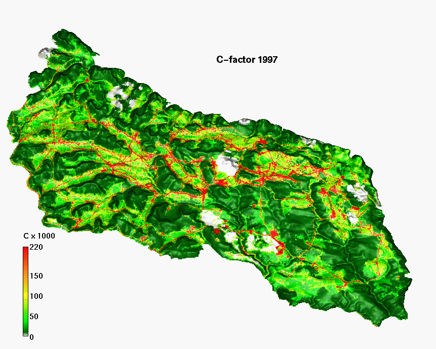