. The model represents the elevation surface with all features (e.g.forests, buildings) on top of it. It does not represent bare ground elevation and therefore its use for modeling is problematic.
Helena Mitasova, Lubos Mitas
University of Illinois at Urbana-Champaign
http://www2.gis.uiuc.edu:2280/modviz/protected/hohen/hoh1.html
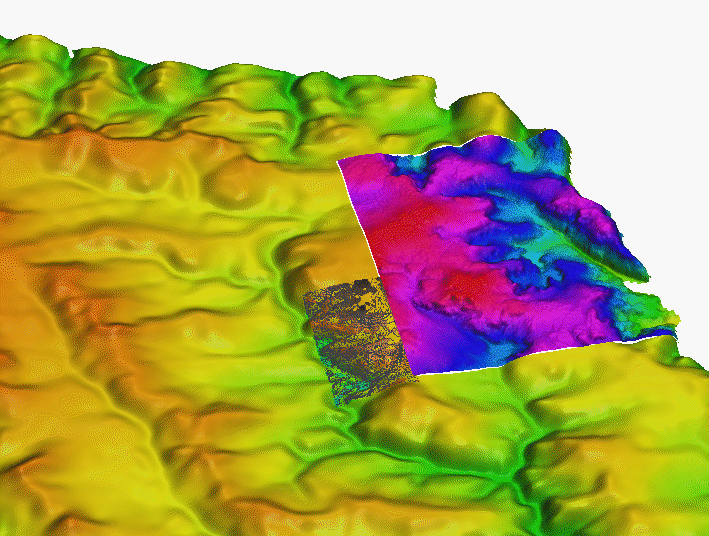
Sample from 10m resolution DEM developed using remote sensing technology
.
The model represents the
elevation surface with all features (e.g.forests, buildings) on top of it.
It does not represent bare ground elevation and therefore its use for
modeling is problematic.
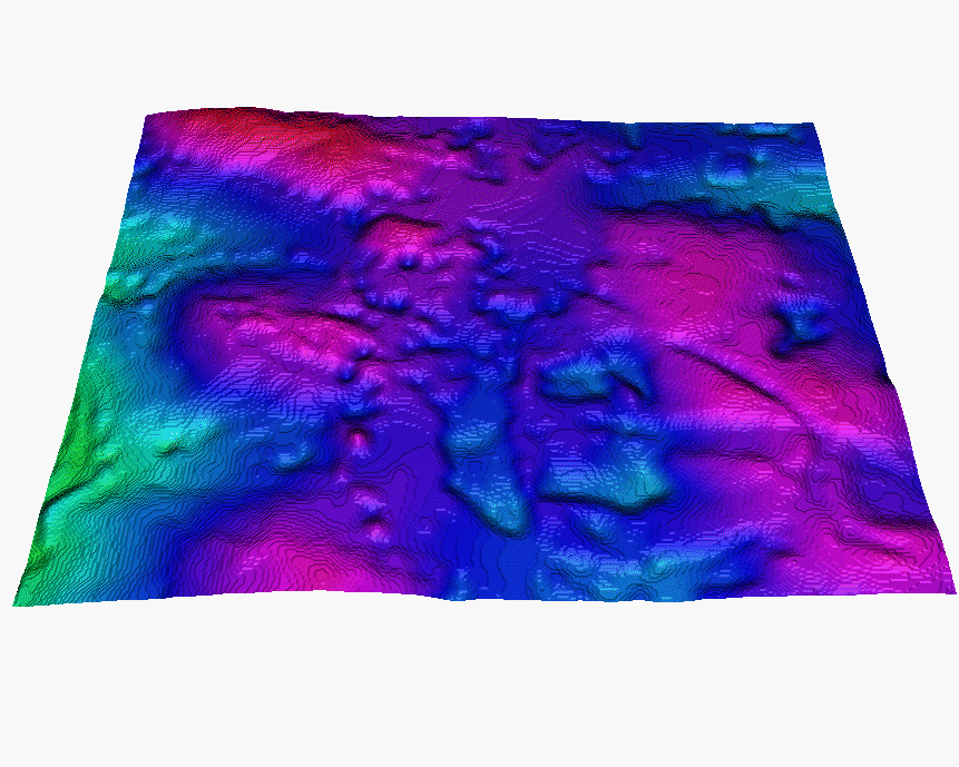
Sample from a new 4m resolution DEM (also RS technology - radar?)
DEM 10m for entire installation with 4m DEM insert
DEM 10m, with 4m DEM insert and 1m contours for area where
we have 2m DEM
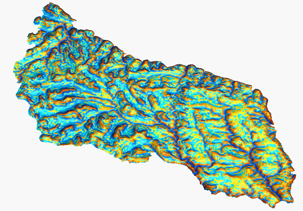
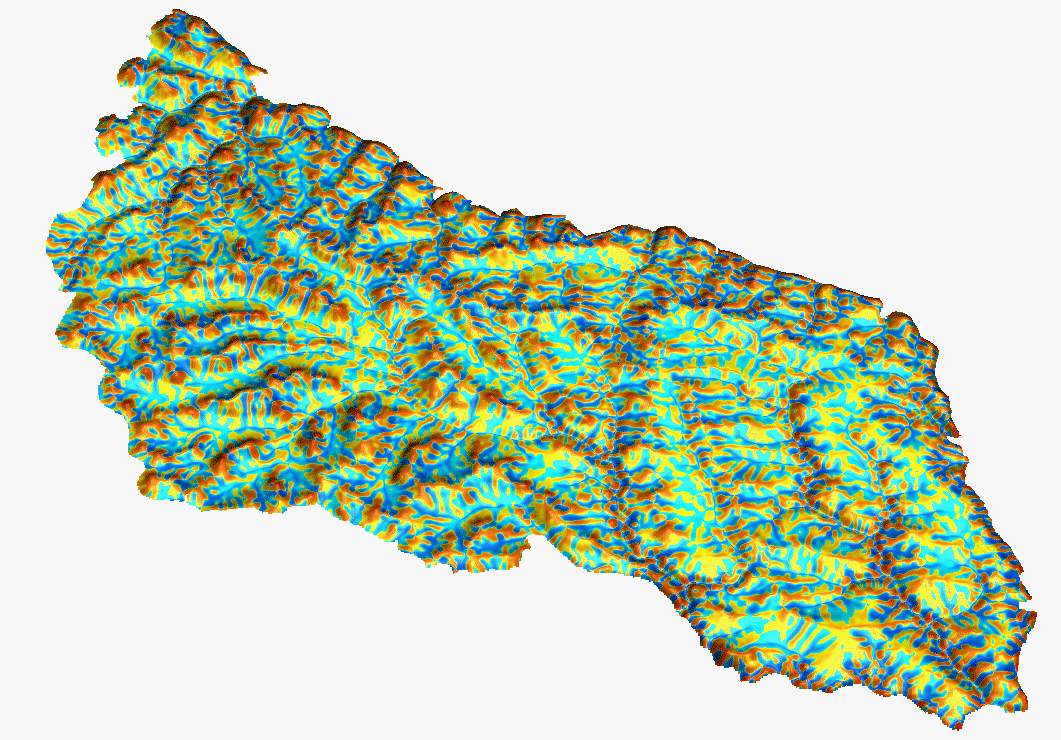
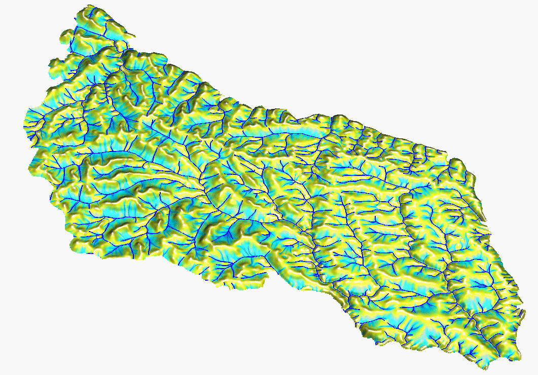
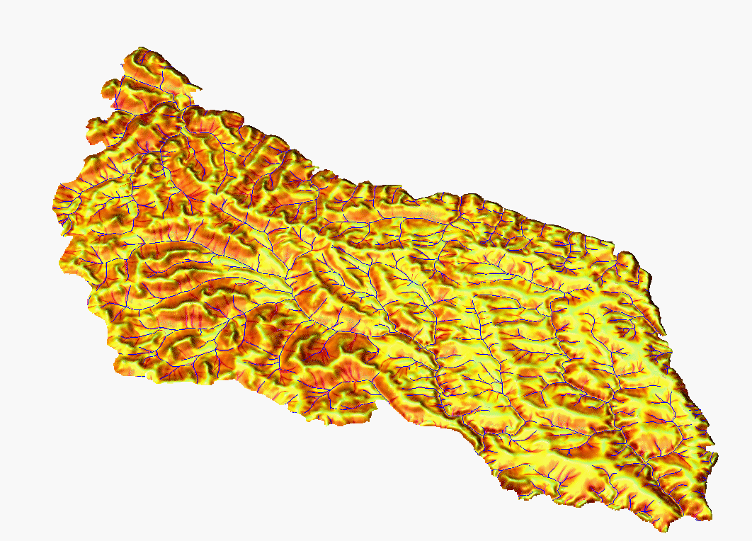
10m resolution DEM computed from 5m contours by s.surf.rst, with simultaneous estimation of topographic parameters:
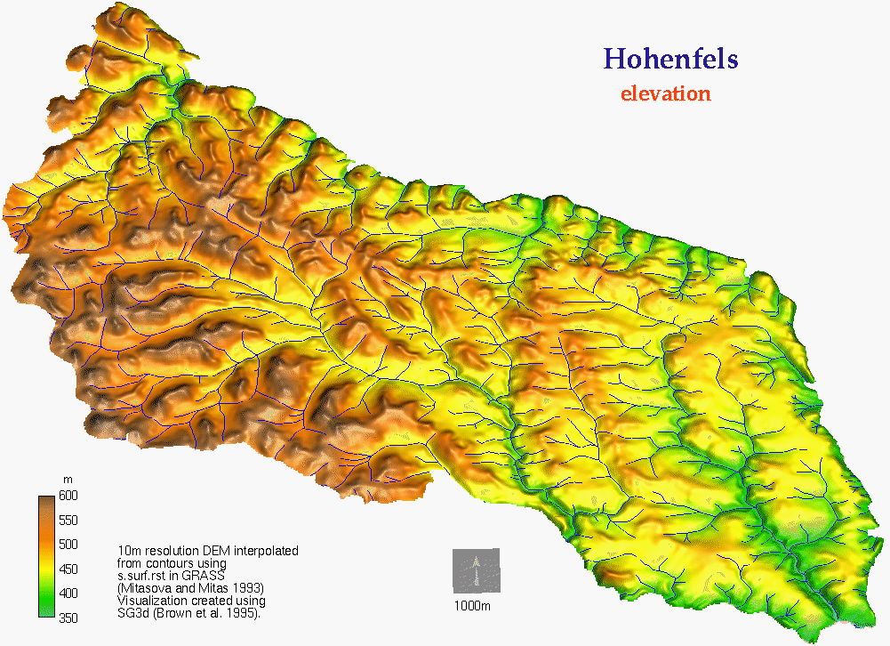 elevation
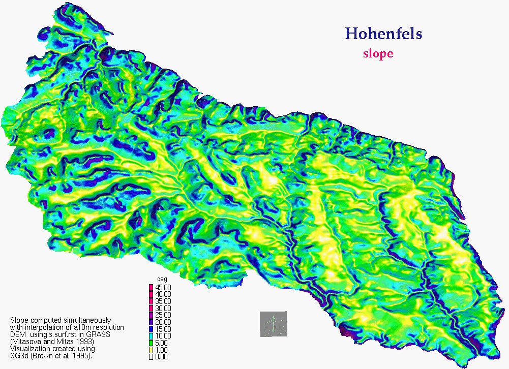 slope
slope
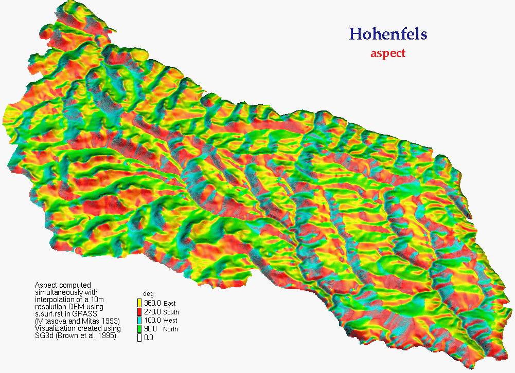 aspect
 profile curvature
 contour curvature
Topographic potential for water and sediment flow and net erosion deposition modeled by USPED for the entire installation at 10m resolution:
 upslope area (steady
state water flow)
upslope area (steady
state water flow)
 detachment limited erosion
potential for uniform cover = modified USLE LS-factor
detachment limited erosion
potential for uniform cover = modified USLE LS-factor
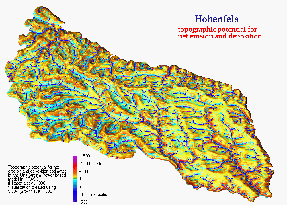 net erosion/deposition
(transport capacity limited case for uniform cover = topographic
potential for erosion/deposition by USPED
net erosion/deposition
(transport capacity limited case for uniform cover = topographic
potential for erosion/deposition by USPED
 GMSL Home Page
 GMSL Modeling & Visualization Home Page