
SPATIAL MODELS OF SOIL PROPERTIES
HELENA MITASOVA, LUBOS MITAS, WILLIAM M. BROWN
GMSLab, University of Illinois at Urbana-Champaign
DRAFT !
1. Introduction:
problem (Mitas and Mitasova 1997) soil analysis is needed for assesing
the fertilizer need, suitability for certain crop or vegetation,
assessing polution and erosion damage (inputs for erosion model, impact
of erosion on soils) etc.
2. Methods
Interpolation: 2D and 3D RST (regularized spline with tension
and smoothing: theory and properties; see Mitas and Mitasova 1988,
Mitasova and Mitas 1993, Mitasova et al. 1995, Mitas and Mitasova 1997,
Mitas and Mitasova: in preparation) link to interp.html
Visualization:
-
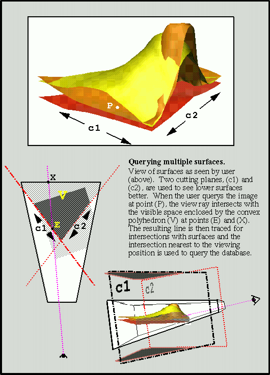
 Improved query algorithm.
Developed code for improved 3D surface query performance.
Query function allows use of arbitrary clipping planes (in addition
to the parallelepiped view volume) and multiple surfaces at variable
resolutions, each with a unique mask.
The basic algorithm is as follows:
- transform selected point on view plane to a view ray
- intersect view ray with convex polyhedron defined by the intersection of the parallelepiped view region with any user defined clipping planes.
- if ray enters this polyhedron, trace ray to find any intersections with visible (unmasked) parts of any surfaces
Note: View ray is traced to find intersection with surface by following
the projection, or "shadow" of the ray along each polygon of
the surface until the shadow passes above the view ray
(when viewing from above the surface).
The previous implementation traced the view ray itself, until a point below
the surface was found and then used binary recursion to pinpoint the
intersection. Sharp peaks and spikes were easily missed and the selection
of the inital "step" down the view ray was critical and needed to be
adjusted for various data ranges and exaggerations. The new strategy
results in faster point selection and an exact intersection.
- choose closest intersection to viewer (or return an ordered list)
- query the database (data sources for color and terrain) directly using
geographic coordinate of intersection(s).
Such point-on-surface functionality is useful for 3D data querying,
setting center of view, placing geographic objects or scales, and
setting center of rotation for vector transformations.
-
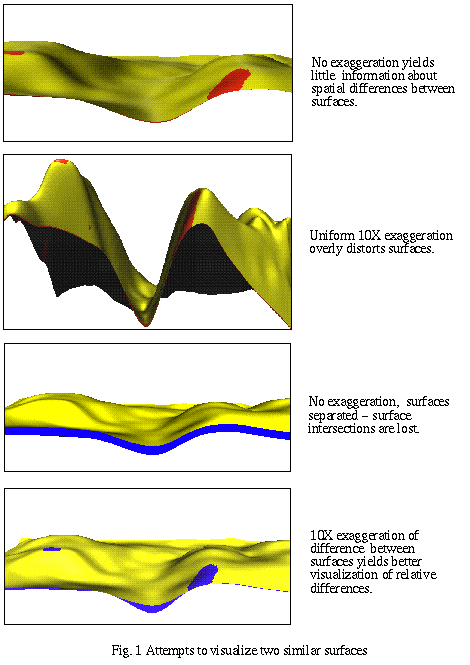
 Relative scaling.
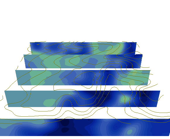
Multiple surfaces are quite useful to visualize boundaries of
layers. For example, surfaces may be created that represent
soil horizons so that thickness of layers may be displayed.
This presents a technical challenge in terms of dimensional
scale. To study differences between two similar
surfaces, we use a scaled difference approach where only
the spatial distance between surfaces is exaggerated,
maintaining correct surface intersections. In other words, one
or more surfaces are scaled relative to a base surface.
This concept of a base surface (e.g., bedrock or surface terrain
in soil studies) has been integrated within visualization tools
to make it easier to experiment with selection of the base
surface. Similarly, 3D volume data from orthogonal regions
may be warped to lie along a (possibly exaggerated) base surface,
to explore the effect of terrain on the volumetric feature being modeled.
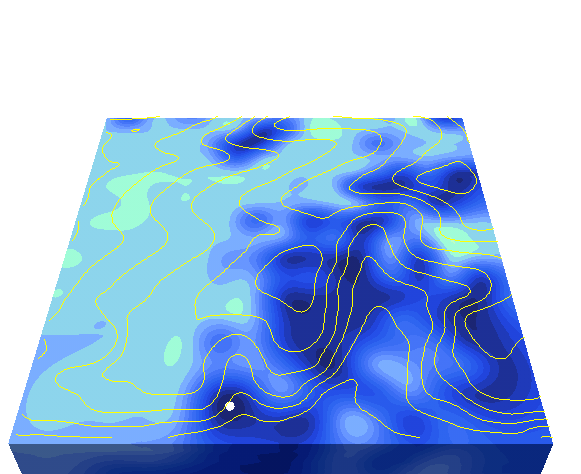
- Volume visualization.
Volume visualization has been implemented on top of the new GRASS
"grid3" data access library, resulting in the two programs
r3.mkdspf and
r3.showdspf.
These programs will be combined and
incorporated into the primary visualization tool, NVIZ, which
has been ported to use the OpenGL graphics library standard. Use of
the grid3 library should allow us to resample volume data on the
fly, enabling more interactive volume exploration. The following
volume visualization methods will be incorporated:
- isosurfaces - currently precomputed by r3.mkdspf and displayed by
r3.showdspf, will be computed as needed at selectable resolution and
for smaller subregions and displayed within NVIZ.
- fence diagrams - currently available for multiple surfaces within
NVIZ and for volume data using r3.showdspf, will be integrated within
NVIZ.
- volume rendering - will be implemented using 3D texture extension to
OpenGL and optimized volume slicing.
3. Results
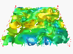
All volume models have vertical exageration 100
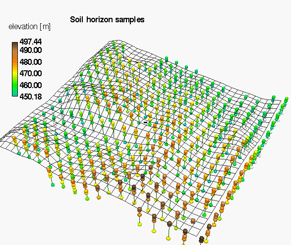
Soil horizons
 sites
sites
 movie
movie  land
use
land
use
Long term traditional land use had a significant impact on spatial
distribution of chemicals in soil, as shown in the following examples.
![]()
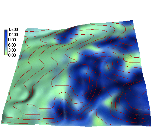
Soil chemistry analysis:
a) soil reaction (ph)
Volume model incorporates the vertical relationship into interpolation
and allows more efficient visual analysis
The highest acidity is on terrain surface in grass area and it extends
over most of the area in deeper horizons
b) organic carbon
The highest concentration of organic matter is in the long term grass
area. The amount of organic matter rapidly decreases with depth.
c) plant available K
Area has surplus of Potassium with maximum concentrations in grassy
area (serves as filter/accumulation area?). Concentrations decrease
with depth, except for a hop field in valley where the higher
concentrations extend well bellow the A horizon.
d) plant available P
Area has surplus of Phosphates, with maximum concentrations in valleys
(depressions) Concentrations decrease with depth...? (volume model,
solid: opt, surplus)
Location of optimal and surplus K, P : intersection of solids
Note that the optimal concentrations od K,P cover only a small surface
area (find better visualization for this) and they are located mostly
bellow surface in lower horizons.
e) total nitrogen
f) bulk density
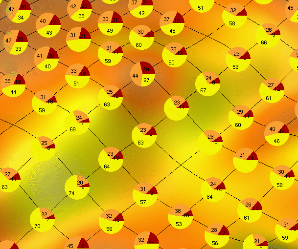
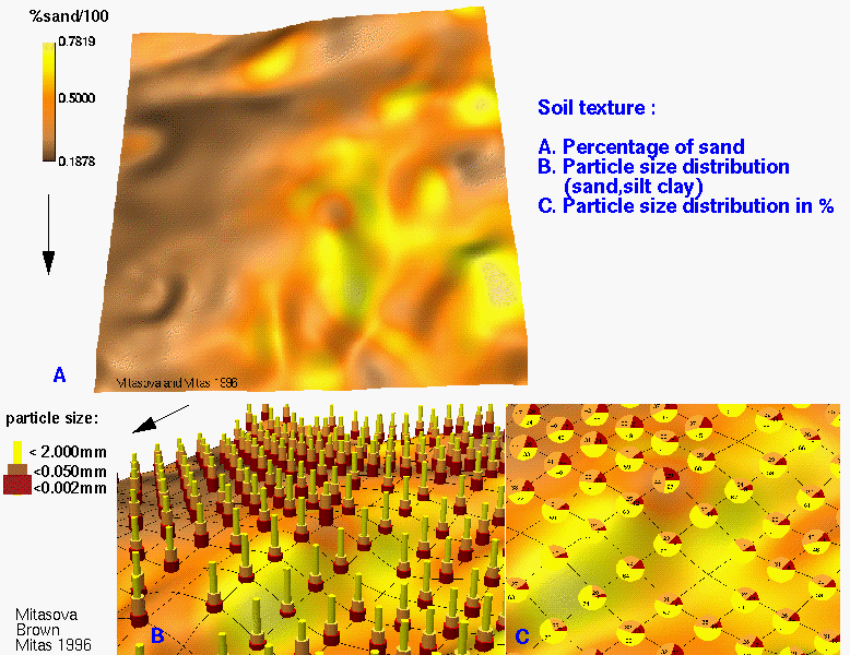
Size fraction analysis:
Soil color:
Soil texture and structure:
qualitative/descriptive data, use point symbols
Derived soil parameters:
a) hydraulic conductivity
The values of hydraulic conductivity were derived for each 3D point
based on the particle size distribution using equations from WEPP
manual. The values were then interpolated to a 3D raster which can be
used as an input for 3D infiltration model or visualized using
isosurfaces or crossections:
4. Application to land management
5. Conclusion
Highest concentrations, acidity, chemicals in grassy area - does it
serve as depository/filter? K,N,P different behavior as they have
different location of max. concentration....
6. References
The document is copyrighted,
send requests to use the images to helena@gis.uiuc.edu
 GMSL Modeling & Visualization
Home Page
 Improved query algorithm.
 Relative scaling.
 slicing
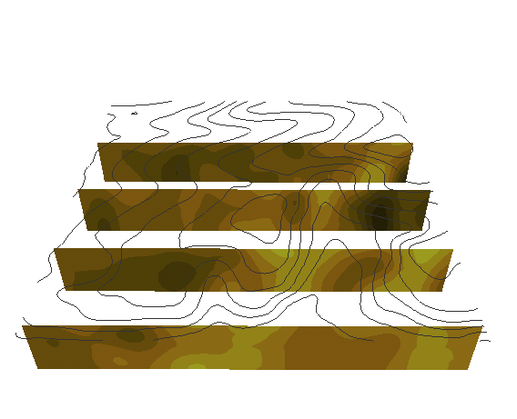
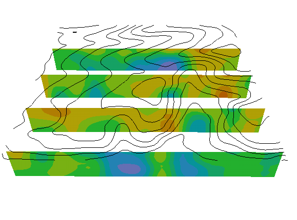 fence
diagram (row=40,80,120,160)
fence
diagram (row=40,80,120,160) 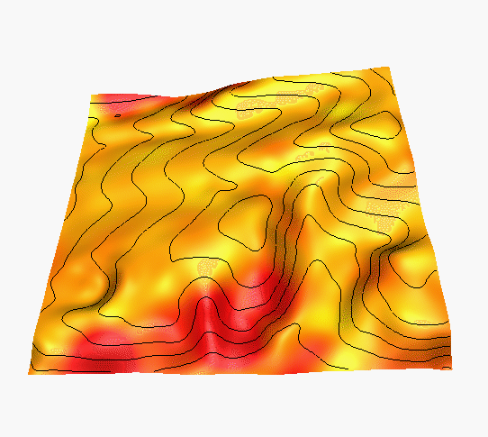
 sites
sites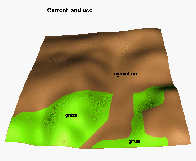 land
use
land
use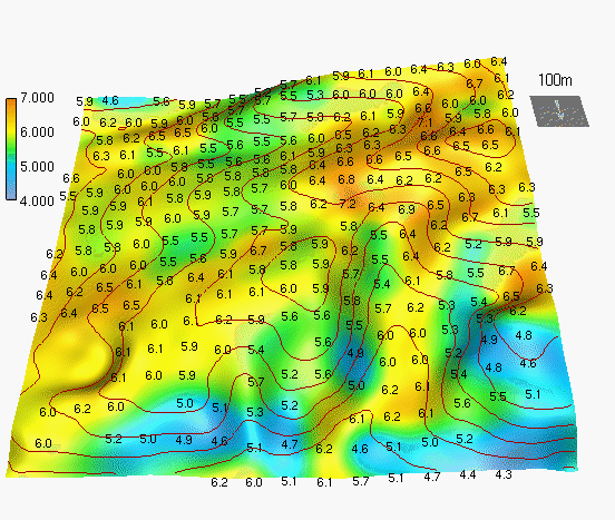 hor 1
hor 1 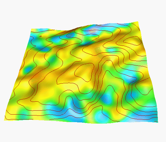 hor 3
hor 3 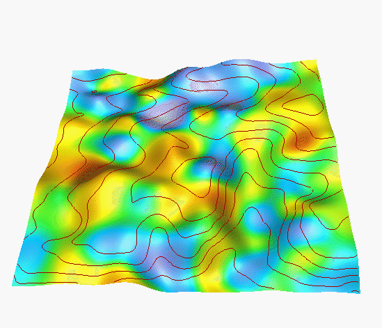 hor 5
hor 5 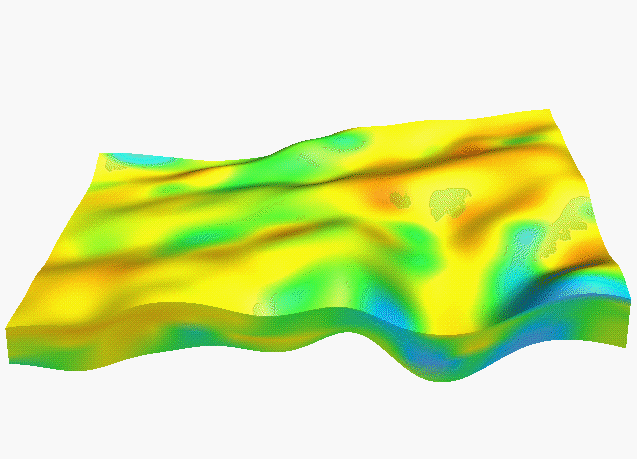 y=100
y=100 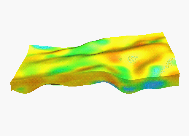 y=140
y=140 
 movie
movie 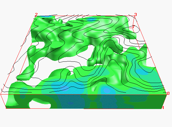 acid
acid 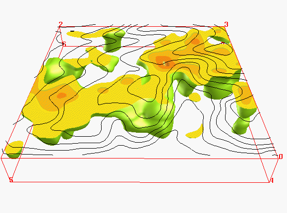 neutral
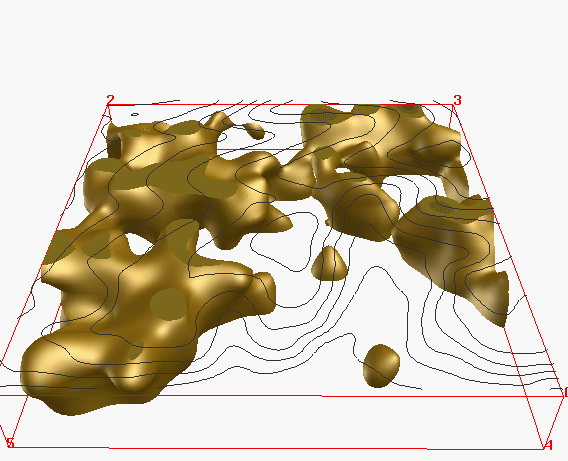
 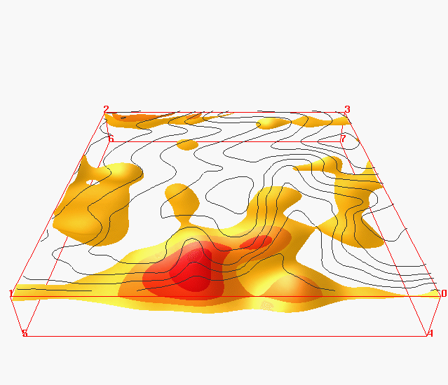 isosurfaces
 box-movie
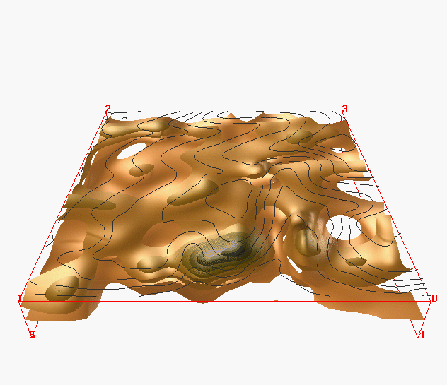 isosurfaces
 fence
diagram
fence
diagram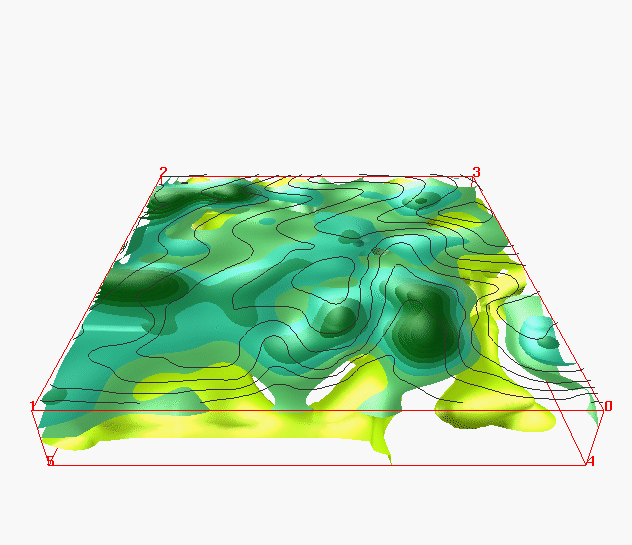 isosurfaces
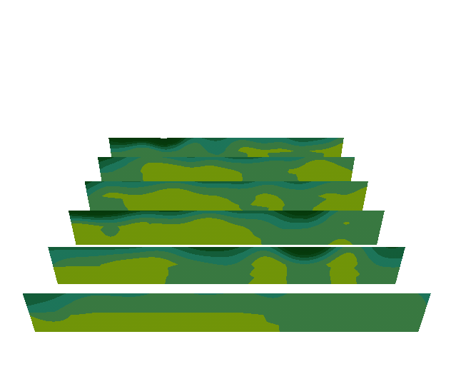 fence
diagram
fence
diagram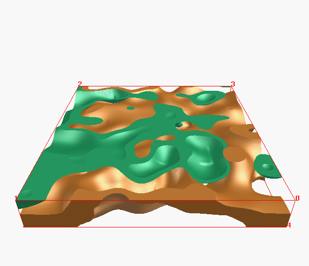 optimal
Kc,Pc
optimal
Kc,Pc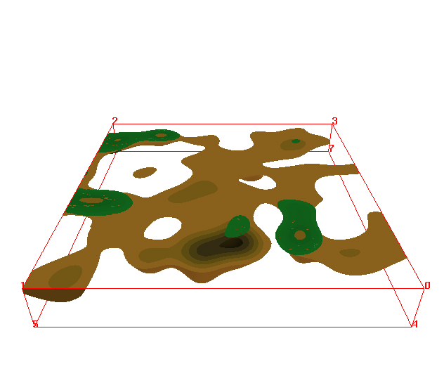 surplus
Kc,Pc
surplus
Kc,Pc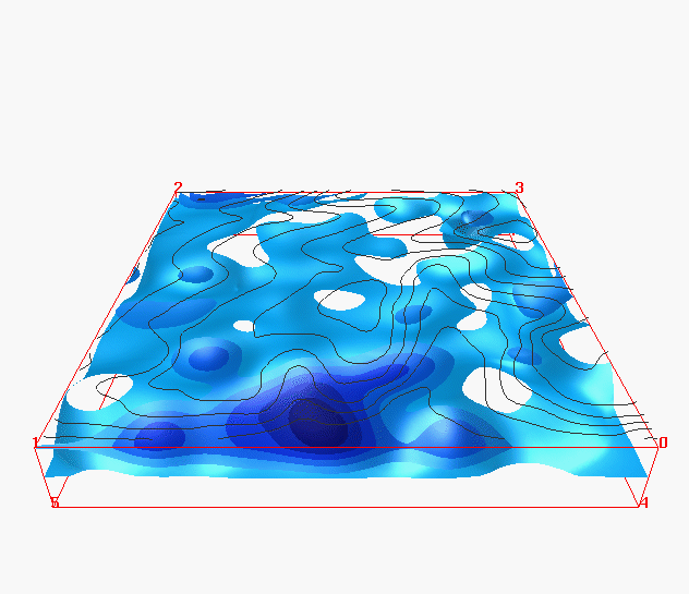 isosurfaces
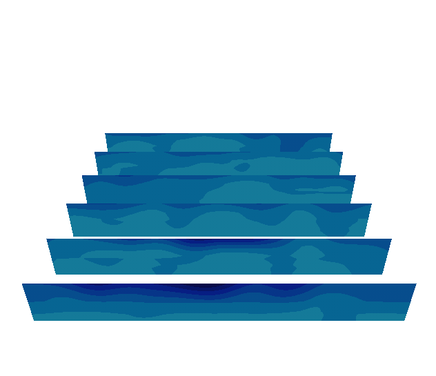 fence
diagram
fence
diagram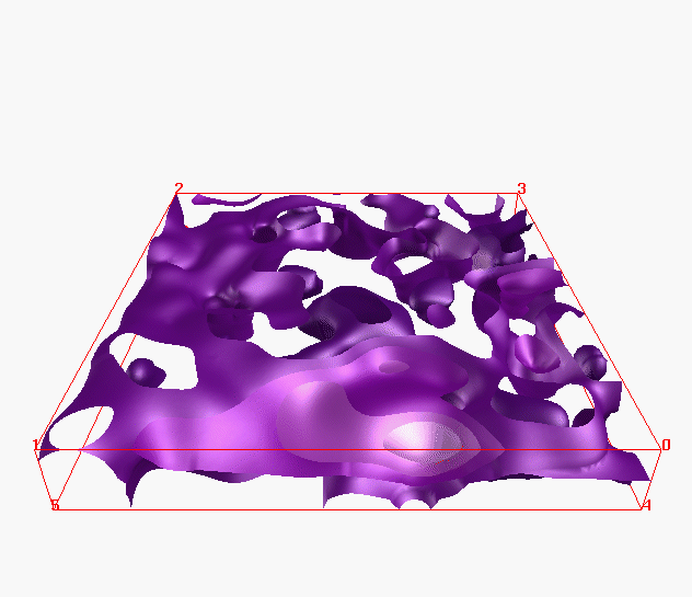 isosurfaces
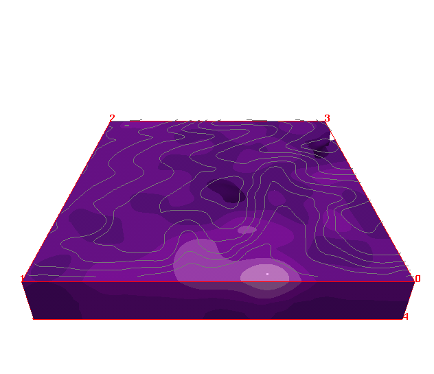 movie
movie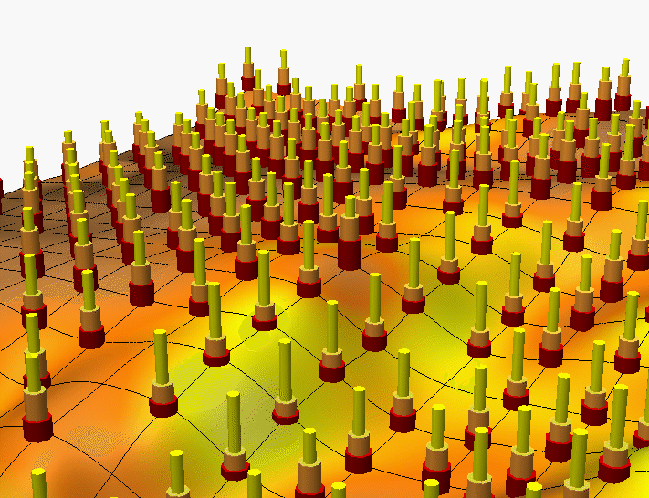
 sand
[%]
sand
[%] clay
[%]
clay
[%] clay
[%]
clay
[%] clay
[%]
clay
[%] high%
high%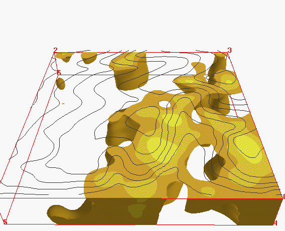 low[%]