Accomplishments
RST method with simultaneous topographic analysis was
applied to several types of data used for characterization of nearshore
and coastal environment:
-
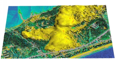
LIDAR: Jockey's ridge. The surface was interpolated
and its geometry was analyzed using different data densities and interpolation
parameters and simultaneous computation of gradients and curvatures at
various levels of detail. The results demonstrate the flexibility of the
RST to adjust its properties to the required level of detail. The possibilities
to improve the performance were identified and the solutions are being
tested with the goal to speed-up the computation for high density data
points. The 3D view of Jockey's Ridge with draped IR-DOQQ were created
using GRASS tool NVIZ.

-
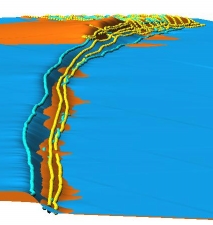
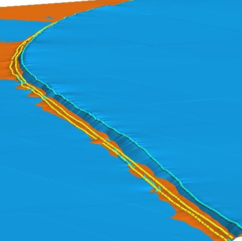
LARC and from RTKS measurements were interpolated
and curvatures were computed to evaluate the RST capabilities to generate
surfaces from profile data with directional oversampling. The anisotropy
is being implemented so that the interpolation parameters can be set to
preserve the maximum detail in the profile data. The shoreline data
from december (orange) and january (blue) were visualized in NVIZ to visualy
assess the eroding shoreline (orange areas have eroded, blue have gained).
Spheres show the measurements performed by Tom Drake and Dave Bernstein.


 Technology Transfer
The description of processing of LIDAR data has been
included in the book about Open source GIS: the GRASS GIS approach, to
be published in the year 2002.
All improvements are tested and immediately released
with the development version of GRASS GIS and regular releases.
Multi-scale characterization and simulation of near-shore environment
using Open source GIS technology. Dr. Helena Mitasova, NCSU


 Technology Transfer