|
|
|||||
|
Using
Soil Erosion Modeling for Improved Conservation Planning: |
|||||
|
|
|||||
|
Using
Soil Erosion Modeling for Improved Conservation Planning: |
|||||
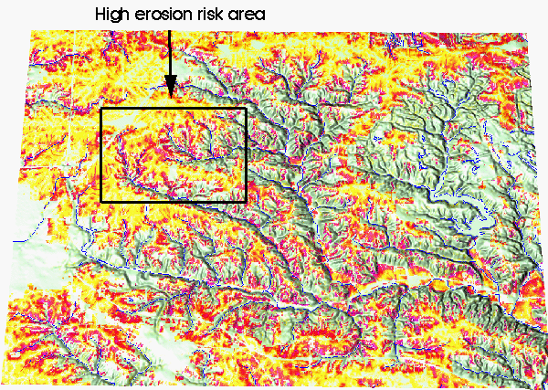
Location of High Risk Erosion Area
in Court Creek Watershed
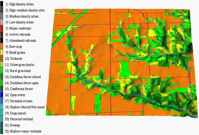
Existing Land Use
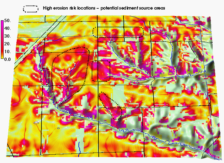
Erosion Risk Estimated by
Modified USLE
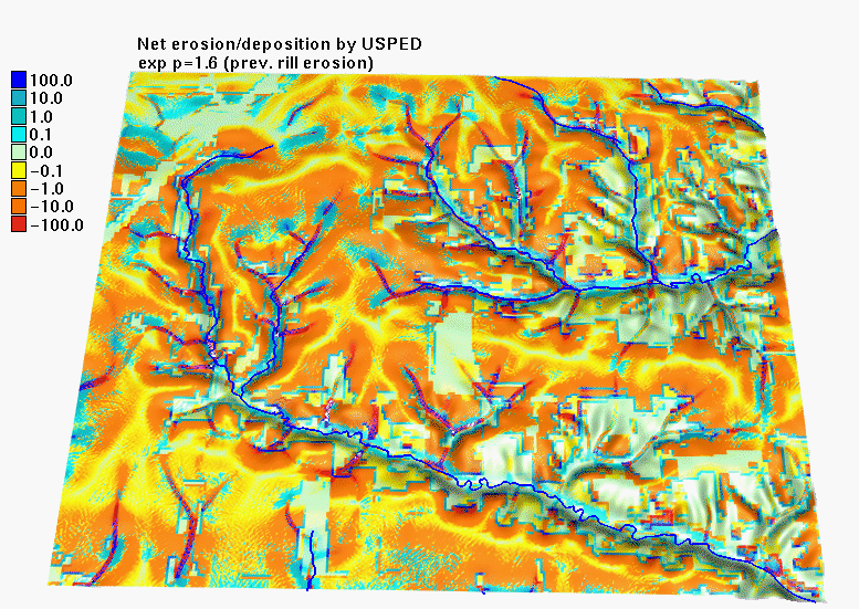
Net erosion/deposition estimated by USPED with the exponent p=1.6 (typical for prevailing rill erosion)
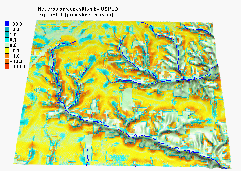
Net erosion/deposition estimated by USPED with the exponent p=1.0 (prevailing sheet erosion)
|
|


