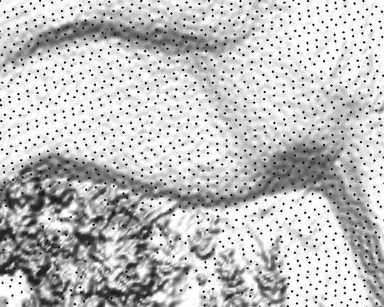
 Figure 3a (full view) Raw point data assigned to 1m resolution raster
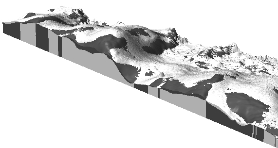
 Figure 3b (full view) Data assigned to 3m resolution raster, outliers were removed
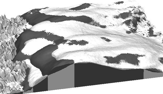
 Figure 3c (full view) Data interpolated to 1m resolution raster by RST
Mitasova, Helena and Hofierka, Jaroslav:
Impact of new mapping technologies on communication of geospatial information.
Kartograficke listy, 2003.
Abstract
GPS, new sensors and increased computational power have dramatically changed mapping of Earth systems. Highly automated data acquisition from space, air and ground enables collection of massive amounts of data at short time intervals creating spatio-temporal, digital representations of landscape features at unprecedented level of detail and accuracy. Advances in computer graphics and data distribution via Internet are changing the communication of geospatial information by increased use of electronic media with high level of interaction, dynamics and 3D visualization. To illustrate some of these trends examples of terrain mapping using LIDAR and Real Time Kinematic GPS are presented.
Figures
Figure 3a (full view) Raw point data assigned to 1m resolution raster
Figure 3b (full view) Data assigned to 3m resolution raster, outliers were removed
Figure 3c (full view) Data interpolated to 1m resolution raster by RST
Additional images are at North Carolina Outer Banks - Evolution of Jockey's Ridge
Fly-through animation is at Open OSX web site, the Quicktime movie is the best
Photos
The LIDAR data are from:
LDART
NC Floodplain Mapping Program