
 developed with GRASS5.0
Copyright © 1999 Helena Mitasova and Lubos Mitas
(note: this document contains unpublished material,
please cite this document and papers Mitasova
et al 1996, Mitas and Mitasova 1998,
when using this material in publications)
where i[m] is uniform rainfall intensity (note: approximation by upslope area neglects the change in flow velocity due to cover). For the uniform soil and cover properties represented by Kt=const., the net erosion/deposition rate is estimated as a divergence of the sediment flow (see Appendix in Mitas and Mitasova 1998):
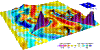
where s(r) is the unit vector in the steepest slope direction, h(r) [m] is the water depth estimated from the upslope area A(r), kp(r) is the profile curvature (terrain curvature in the direction of the steepest slope), kt(r) is the tangential curvature (curvature in the direction tangential to a contourline projected to the normal plane). Topographic parameters s(r), kp(r), kt(r) are computed from the first and second order derivatives of terrain surface approximated e.g., by the RST (Mitasova and Mitas, 1993; Mitasova and Hofierka, 1993; Krcho 1991). According to the 2D formulation, the spatial distribution of erosion and deposition is controlled by the change in the overland flow depth (first term) and by the local geometry of terrain (second term), including both profile and tangential curvatures. The bivariate formulation thus demonstrates that the local acceleration of flow in both the gradient and tangential directions (related to the profile and tangential curvatures) play equally important roles in spatial distribution of erosion/deposition. The interplay between the magnitude of water flow change and both terrain curvatures reflected in the bivariate formulation determines whether erosion or deposition will occur.
No experimental work was performed to develop parameters needed for
USPED, therefore we
use the USLE or RUSLE parameters to incorporate the impact of soil
and cover and obtain at least a relative estimate of net erosion and deposition.We
assume that we can estimate sediment flow at sediment transport capacity
as
where a [deg] is aspect of the terrain surface.This equation
is equivalent to the relationship with curvatures presented above, however
the computational procedure is simpler.
Caution should be used when interpreting the results because
the USLE parameters were developed for simple plane fields and detachment
limited erosion therefore to obtain accurate quantitative predictions for
complex terrain conditions they need to be re-calibrated ( Foster 1990,
Mitasova et al 1997 reply).
Given data:
raster: elevation, K, C, (P)
constant: R=120,resolution=10Computation
Copyright © 1999 Helena Mitasova and Lubos Mitas
1. r.flow elevation dsout=flowacc
2. r.slope.aspect elevation slope=slope aspect=aspect
3. r.mapcalc
explain normalization/units here
sflowtopo=exp(flowacc*resolution,1.6)*exp(sin(slope),1.3) (prevailing rills)
or sflowtopo=flowacc*resolution*sin(slope) (prevailing sheet)
qsx = 120 * K * C * sflowtopo * cos(aspect)
qsy = 120 * K * C * sflowtopo * sin(aspect)
4. r.slope.aspect qsx dx = qsx.dx
5. r.slope.aspect qsy dy = qsy.dy
6. r.mapcalc
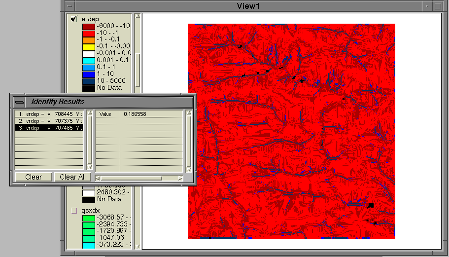
erdep = qsx.dx + qsy.dy , for prevailing rill erosion
erdep = 10 * (qsx.dx + qsy.dy) , for prevailing sheet erosion
7. Optional: create new color table, reclass to erosion/deposition risk classes,
run statistics, ...2.2 ArcView-Spatial Analyst
Given data
grid: elevation, K, C, (P), Important! K and C should be multiplied at least by 100
to avoid problems when displaying the results
constants: R=120,resolution=10Computation
Copyright © 1999 Helena Mitasova and Lubos Mitas
1. select elevation
DERIVE SLOPE
name it slope
DERIVE ASPECT
name it aspect
2. MAP CALCULATOR
([elevation].FlowDirection(FALSE)).FlowAccumulation(NIL)
name it flowacc
3. MAP CALCULATOR add normalization in this step
   build an expression (prevailing rill erosion):

    (([flowacc] * resolution).Pow(1.6))* ((([slope]*0.01745).Sin).Pow(1.3))

    Evaluate

   name it sflowtopo
or for prevailing sheet erosion
([flowacc] * resolution)* (([slope]*0.01745).Sin)
Evaluate
name it sflowtopo
build an expression
(((([aspect]*(-1))+450)*0.01745).Cos)*[sflowtopo]*[K]*[C]*R
Evaluate
name it qsx
(((([aspect]*(-1))+450)*0.01745).Sin)*[sflowtopo]*[K]*[C]*R
Evaluate
name qsy
4. select qsx
DERIVE SLOPE
name it qsx.slope
DERIVE ASPECT
name it qsx.aspect
5. select qsy
DERIVE SLOPE
name it qsy.slope
DERIVE ASPECT
name it qsx.aspect
6. MAP CALCULATOR
build an expression
(((([qsx.aspect]*(-1))+450)*0.01745).Cos)*([qsx.slope]*0.01745).Tan
name it qsx.dx
build an expression
(((([qsy.aspect]*(-1))+450)*0.01745).Sin)*([qsy.slope]*0.01745).Tan
name it qsy.dy
build an expression
[qsx.dx] + [qsy.dy] for prevailing rill erosion
([qsx.dx] + [qsy.dy]) * 10. for prevailing sheet erosion
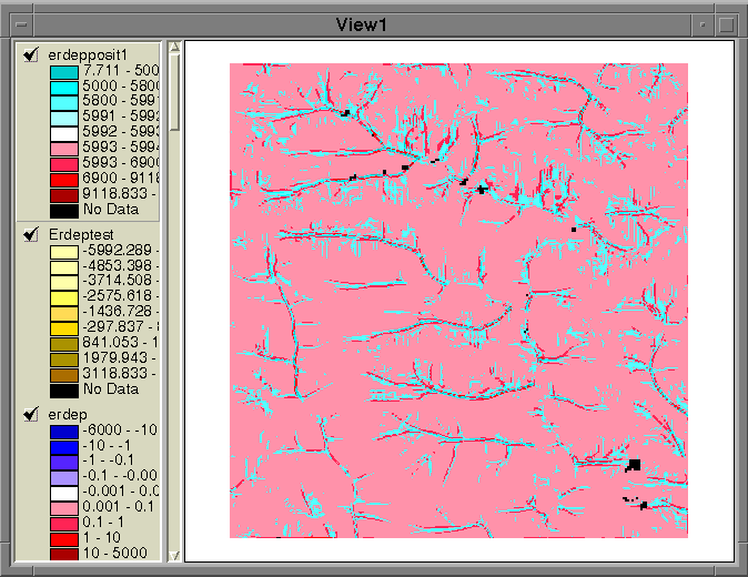
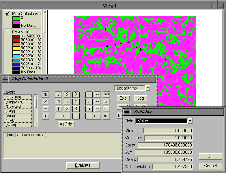
name it erdep(keep in mind that the values are multiplied by the values used to multiply the C and K factors. Do not divide to get the correct values, because the pattern with values in interval <-1,1>, typical for well preserved areas as well as upland, relatively flat areas, will be lost.)
7. Optional: create a new color table, reclass to erosion/deposition risk classes,
run statistics, ...
Given data

grid: elevation, K, C, (P)

constant: R=120, resolution=10


Computation

1. Enable Spatial Analyst

   under View... Toolbars  select Spatial Analyst

2. Calculate Slope and Aspect

   from the Spatial Analyst toolbar, select Surface Analysis... Slope

   give the new theme name slope

   from the Spatial Analyst toolbar, select Surface Analysis... Aspect

   give the new theme name aspect

3. Raster Calculator

   from the Spatial Analyst toolbar, select Raster Calculator

   build an expression:

   FlowAccumulation(FlowDirection([elevation]))

   Evaluate

   make the new theme permanent and change the name to flowacc

   build an expression in the Raster Calculator:

   (for prevailing rill erosion):
   Pow([flowacc] * resolution , 0.6) * Pow(Sin([slope] * 0.01745) , 1.3))

   (for prevailing sheet erosion):
   [flowacc] * resolution * Sin([slope] * 0.01745)

   Evaluate

   make the new theme permanent and change the name to sflowtopo

   build an expression in the Raster Calculator:
   # note : the original 280 was changed to 120 to reflect R=120 constant

   [sflowtopo] * [kfac] * [cfac] * 120 * Cos((([aspect] *  (-1)) + 450) * .01745)

   Evaluate

   make the new theme permanent and change the name to qsx

   build an expression in the Raster Calculator:

   [sflowtopo] * [kfac] * [cfac] * 120 * Sin((([aspect] *  (-1)) + 450) * .01745)

   Evaluate

   make the new theme permanent and change the name to qsy

4. select qsx in the Spatial Analysis Toolbar

   select Surface Analysis... Slope

   give the new theme name qsx_slope

   select Surface Analysis... Aspect

   give the new theme name qsx_aspect

5. select qsy in the Spatial Analysis Toolbar

   select Surface Analysis... Slope

   give the new theme name qsy_slope

   select Surface Analysis... Aspect

   give the new theme name qsy_aspect

6. Raster Calculator

   build an expression

   Cos((([qsx_aspect] * (-1)) + 450) * .01745) * Tan([qsx_slope] * .01745)

   give the new theme name qsx_dx

   build an expression

   Sin((([qsy_aspect] * (-1)) + 450) * .01745) * Tan([qsy_slope] * .01745)

   give the new theme name qsy_dy

   build an expression

   [qsx_dx] + [qsy_dy] for prevailing rill erosion
   ([qsx_dx] + [qsy_dy]) * 10. for prevailing sheet erosion

   give the new theme name erdep
Mitasova, H., J. Hofierka, M. Zlocha, L.R. Iverson, 1996, Modeling topographic potential for erosion and deposition using GIS. Int. Journal of Geographical Information Science, 10(5), 629-641. (reply to a comment to this paper appears in 1997 in Int. Journal of Geographical Information Science, Vol. 11, No. 6)
Mitasova 1996 Mitasova, H., L. Mitas, B.M. Brown, D.P. Gerdes, I. Kosinovsky, 1995, Modeling spatially and temporally distributed phenomena: New methods and tools for GRASS GIS. International Journal of GIS, 9 (4), special issue on integration of Environmental modeling and GIS, p. 443-446.
Mitasova et al. 1997,98,99 Applications presented at this WWW site:
Zhang www
Geomodel www